Published
- 5 min read
Abandoned Gold Mines Near You (How to Find Them)
I built a map for exactly this. Check out the GoldFever.app mine map - it shows thousands of abandoned gold mines across the US, and you can zoom right into your area to see what’s nearby.
I spent months compiling USGS data, historic mining records, and state geological surveys into one interactive map. You type in your location, the map shows you old mines. That’s it. That’s what you came here for.
Now let me tell you what to actually expect when you find one.

What You’ll Actually Find at Old Mine Sites
Here’s the thing - most abandoned mines don’t look like the movies. You’re not going to find a perfectly preserved entrance with a “GOLD MINE” sign and glittering ore spilling out.
What I usually find:
A hole in the ground. Sometimes just a collapsed depression. Sometimes an actual tunnel entrance that’s half-caved in. Often covered in brush or obscured by decades of rockfall.
Rusted metal everywhere. Ore cart rails. Cable fragments. Bits of machinery that are impossible to identify. I found an old stamp mill base once that looked like abstract sculpture.
Tailings piles. These mounds of processed rock are often the most visible sign from a distance. They’re basically the leftovers after miners extracted the good stuff. Sometimes you can spot quartz chunks with interesting mineralization.
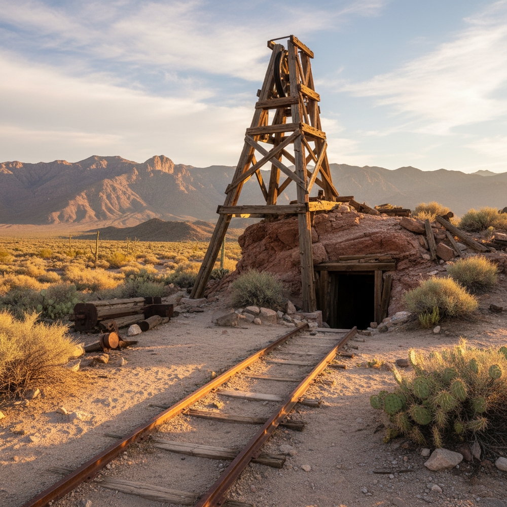
Collapsed structures. Headframes, ore bins, assay offices - whatever’s left is usually barely standing. But honestly, that weathered wood against a mountain backdrop makes for incredible photos.
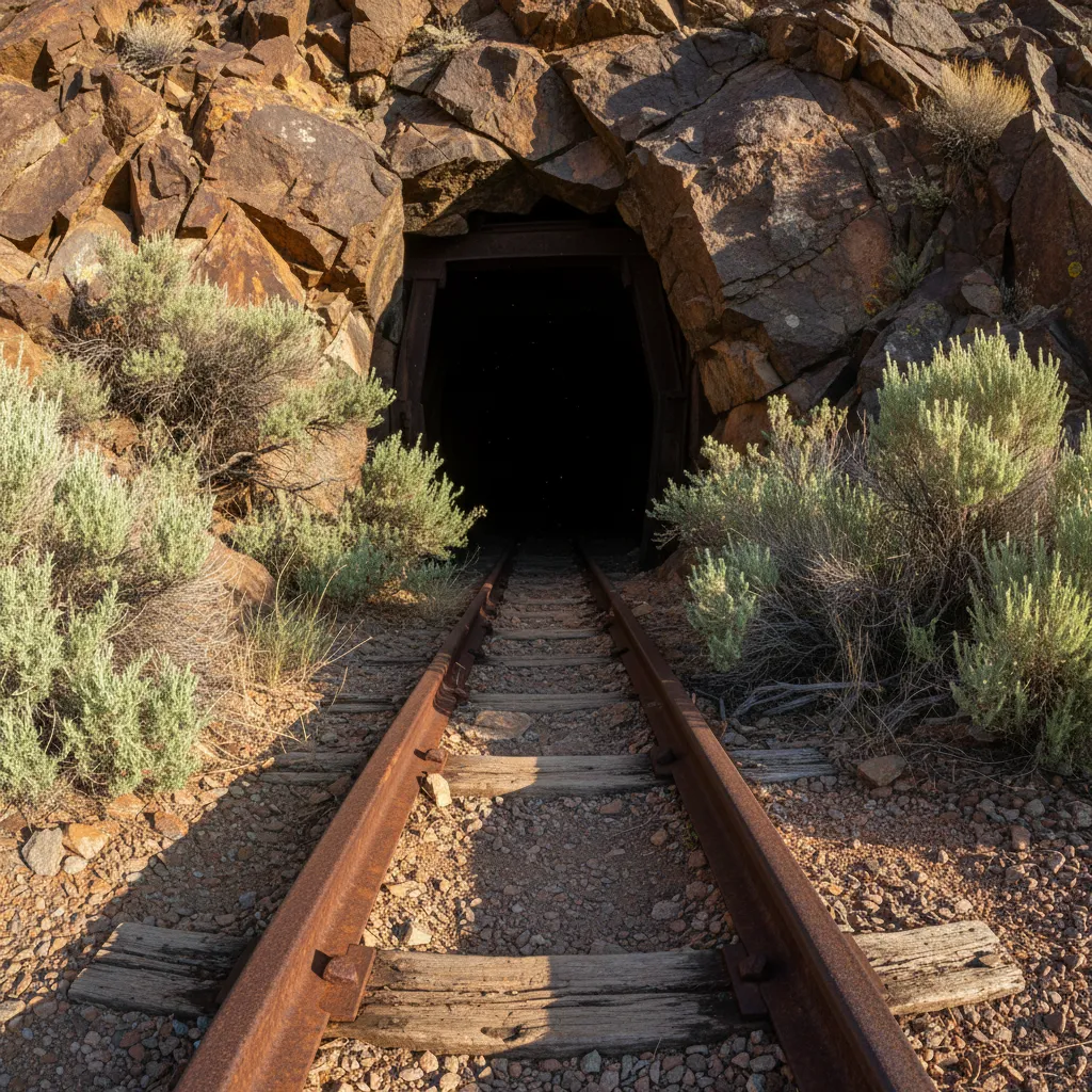
My first time visiting an old mine in the Bradshaw Mountains, I almost walked right past it. Just looked like a dark shadow on a hillside until I got close. The entrance was maybe four feet tall, framed with rotting timber. There was a rusted rail track disappearing into darkness.
I did not go in.
Real Talk About Safety
I’m going to be straight with you because I care about you coming home.
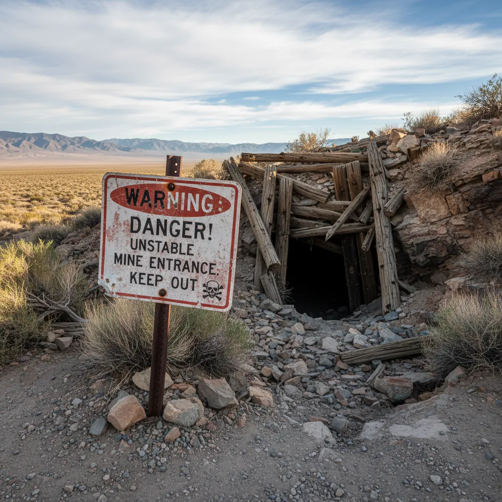
Don’t go inside.
I know that sounds dramatic. But abandoned mines kill people every single year. The people who die aren’t idiots - they’re curious folks who thought “I’ll just peek in” or “it looks stable.”
Here’s what gets people:
Bad air. You can’t see it, smell it, or feel it until you’re unconscious. Carbon dioxide pools in low areas. Methane builds up. Oxygen gets displaced. One breath in the wrong spot and you drop.
Collapses. Hundred-year-old timbers holding up tons of rock. That rock has been slowly shifting for a century. Your footsteps might be what finally triggers it.
Hidden shafts. I’ve heard of vertical drops inside mines covered by rotted planks and a thin layer of debris. You step on what looks like solid ground and you fall two hundred feet. They don’t always find the body.
Surface exploration is where it’s at. The history, the geology, the artifacts - all of that is visible from outside. I’ve spent hours at mine sites photographing equipment, studying the tailings, and imagining what it was like in 1880. Never once felt like I was missing out by not crawling into a death trap.
Bring a buddy. Tell someone where you’re going. Carry water and a first aid kit. Treat every mine opening like it’s actively trying to kill you, because some of them are.
Best Regions for Finding Abandoned Mines
The West is absolutely loaded with old mines. Here’s where I’ve had the best luck:
California Mother Lode. Grass Valley, Nevada City, the whole Highway 49 corridor. The 1849 Gold Rush left thousands of mines here. Many are on public land and you can access the surface areas.
Colorado Mineral Belt. Cripple Creek, Leadville, the San Juans. High elevation, stunning scenery, and mine sites everywhere. Some of the most photogenic abandoned headframes I’ve ever seen.
Nevada. The desert preserves everything. Goldfield and Tonopah have ruins that look almost frozen in time. Less vegetation means you can spot mine sites from further away.
Arizona. Wickenburg, Oatman, the Bradshaws. Heat is brutal in summer but the historic sites are well-preserved and often accessible.
I’ve also found interesting old mines in Utah, New Mexico, and even some Eastern states like North Carolina and Georgia.
How to Use the Map
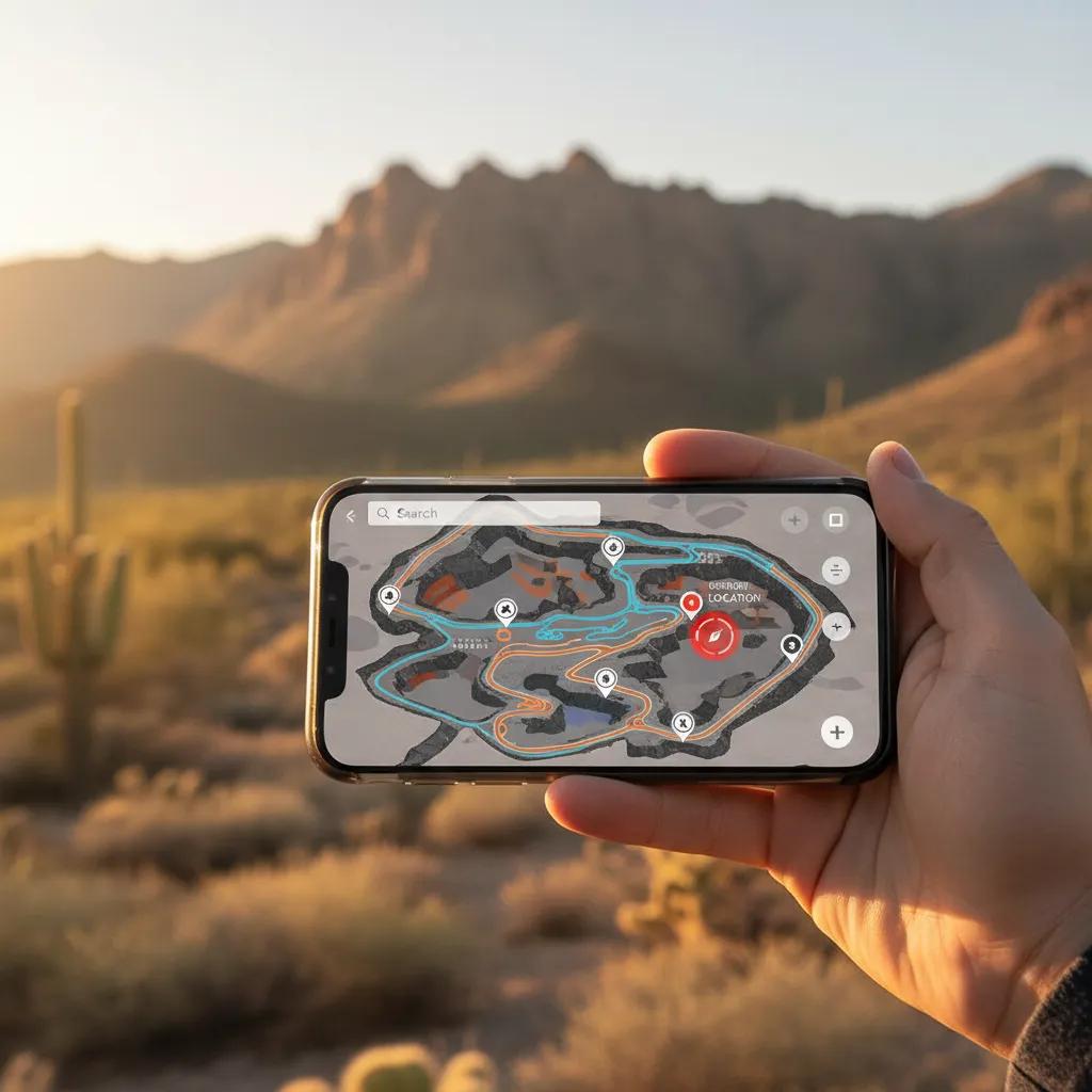
Alright, here’s how to actually find mines near you with GoldFever.app:
- Open the map and let it access your location (or search for wherever you want to explore)
- Zoom in to see individual mine markers appear
- Tap a marker to see the mine name, location, and any available historic data
- Check land status before you go - some mines are on private property or active claims
I’ve included data from USGS Mineral Resources Data System, state geological surveys, and historic mining district records. The map shows both lode mines (hard rock tunnels) and placer operations.
Pro tip: Cross-reference with satellite imagery before you visit. You can often spot tailings piles and access roads from above.
Finding Your First Site
Start with mines that are easy to access and well-documented. Don’t bushwhack into the wilderness for your first visit. Look for sites near established roads or trails.
When you get there, spend time really looking around. Walk the perimeter of the tailings. Examine any equipment or structures from a safe distance. Think about what it took to haul machinery into these remote places a hundred years ago.
Take photos. Lots of them. These sites are slowly disappearing to weather and vandalism. Your documentation has historical value.
And if you find gold in the tailings? That’s a story for another article.
Start exploring the map and let me know what you find near you.