Published
- 13 min read
Gold Panning Laws by State: Where You Can Legally Pan
I got stopped by a Forest Service ranger on Clear Creek in Colorado two summers ago. I thought I had a decent handle on gold panning laws — I knew the basics, or so I figured. I was knee-deep in the water, pan in hand, snuffer bottle tucked in my vest pocket, minding my own business. She walked down the bank and asked if I knew whose claim I was standing on.
I didn’t.
Turns out I was about forty feet inside an active mining claim boundary. The claim holder hadn’t posted signs — a lot of them don’t — but that didn’t matter. I was in the wrong. The ranger was nice about it. She pulled up the BLM records on her phone, showed me exactly where the claim started, and pointed me downstream to a stretch of public ground. No ticket, no fine, just a five-minute conversation that could have gone very differently.
That afternoon I downloaded the GoldFever app and started checking claim boundaries before I set up anywhere. I should have been doing that from day one. If you’re just getting started with gold panning, understanding the legal side is just as important as learning technique. Probably more important, honestly, because bad technique wastes your time but bad legal knowledge can empty your wallet.

The Short Answer: Yes, Gold Panning Is Legal
Gold panning is legal on most public land in the United States. But “most” is doing a lot of work in that sentence.
The rules depend on three things: who owns the land, whether someone has filed a mining claim, and what state you’re in. Get any of those wrong and you’re looking at fines that range from a warning to several thousand dollars. A guy at a prospecting club meeting in Phoenix told me he watched someone get cited $500 for dredging in a creek that had been closed to motorized extraction. Five hundred bucks and a day ruined because he didn’t check the regulations before hauling his dredge out there.
Federal Land Rules
BLM Land (Bureau of Land Management)
BLM land is the gold standard for recreational prospecting. Pun intended, and I’m not sorry.
Under the casual use policy, you can pan for gold on unclaimed BLM land without any permit. Casual use means hand tools only — gold pans, classifiers, hand sluices, crevicing tools. No motors, no suction dredges, no significant disturbance to the surface. If you can carry it in a backpack, you’re probably fine.
What casual use does NOT include:
- Suction dredges — these require separate permits in most states, and some states have banned them entirely
- Highbankers or power sluices — anything with a motor or pump
- Excavation — digging holes, moving large boulders, altering stream banks
- Camping at your site for extended periods as a base of mining operations
The key phrase the BLM uses is “no significant surface disturbance,” codified under 43 CFR § 3809.5. If you leave and nobody can tell you were there, you’re within casual use. If there’s a hole, a pile of tailings, or diverted water, you’ve crossed the line.
National Forest Land
National Forests generally follow the same casual use rules as BLM land. Pan, hand sluice, crevicing tools — all fine without a permit on unclaimed ground. The Forest Service technically has its own regulations separate from BLM, but in practice the casual use standard is nearly identical.
One wrinkle: some National Forests have specific closures or restrictions on certain waterways. The Eldorado National Forest in California, for instance, has sections of the South Fork American River with seasonal restrictions. Always check the local ranger district’s website or call ahead. I know calling a government office sounds about as fun as a root canal, but the rangers I’ve talked to have been universally helpful. They’d rather answer a question than write a citation.
National Parks — Just Don’t
Gold panning is prohibited in all National Parks. Period. No exceptions. No casual use policy. No permits available.
This trips people up because some of the best gold locations in the United States are near or adjacent to National Park boundaries. The line between National Forest and National Park isn’t always obvious on the ground. If you’re prospecting near park boundaries, know exactly where you are. GPS, not guesswork.
I met a guy at a prospecting meetup in Tucson who claimed he’d panned in a national monument “and nobody cared.” Maybe nobody caught him. But the fines for removing minerals from National Park land start at $325 and go up to $5,000 for repeat violations. Not worth it.
Army Corps of Engineers and State Parks
Army Corps land around reservoirs and waterways varies by location. Some allow it, some don’t. State parks are the same — totally dependent on the specific park. There’s no blanket rule. You have to check each one individually, which is tedious but necessary.
![]()
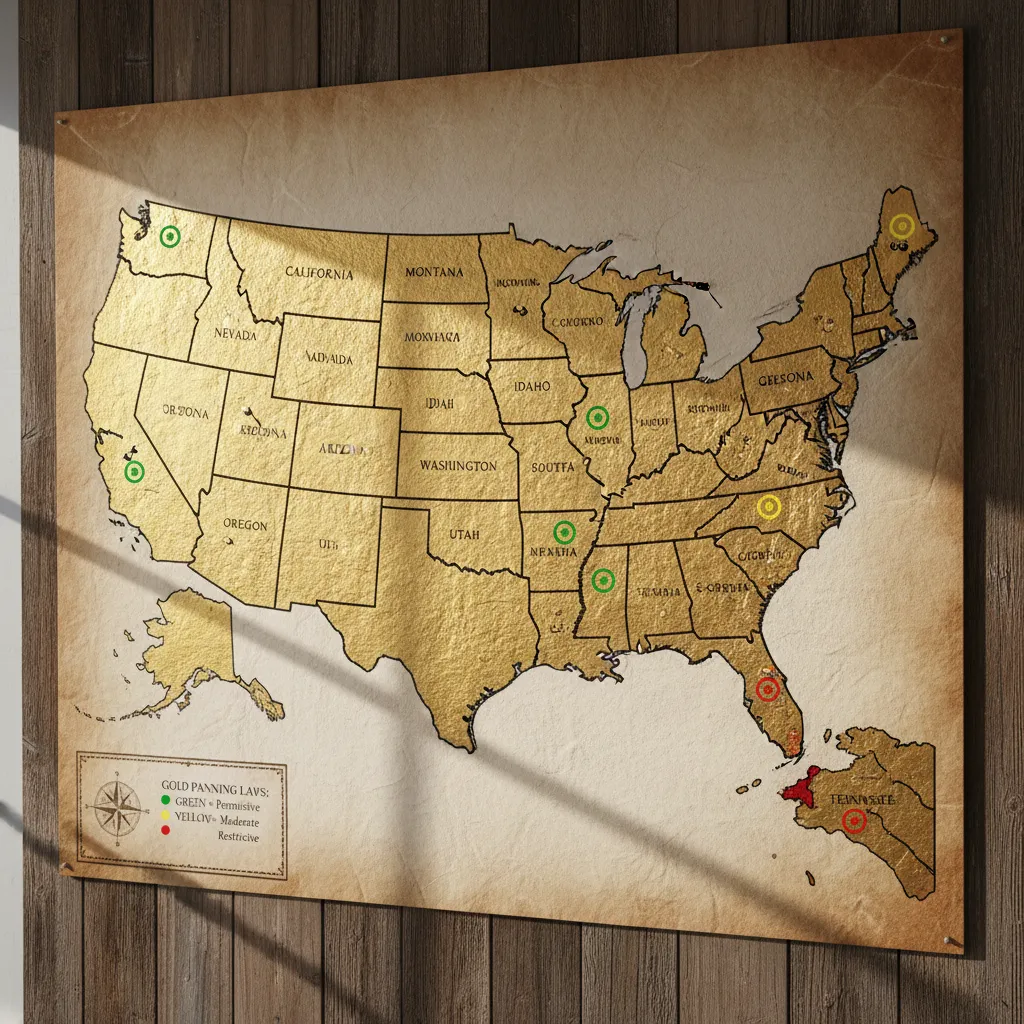
Gold Panning Laws by State
Here’s what I’ve learned from prospecting across the West and talking to other prospectors about their home states. Gold panning laws vary significantly by state — some are prospector-friendly, others have layers of regulation. If your state isn’t listed below, check your state’s Department of Natural Resources or equivalent agency.
California
California has gold everywhere — the Mother Lode country is legendary for a reason — but the regulations are more restrictive than most states.
Hand panning: Legal on BLM and National Forest land under casual use. No permit required.
Suction dredging: Banned statewide since 2009 under a moratorium that keeps getting extended. This is the most controversial prospecting law in the country. The ban was originally “temporary” while environmental studies were conducted. It’s been sixteen years. California prospectors are not happy about it, and I’ve heard opinions on both sides that range from reasonable to unhinged.
Sluice boxes: Hand-fed sluices (no motor) are generally allowed on federal land. Power sluices and highbankers are regulated and may require permits.
Key areas: The South Fork American River near Coloma, the Yuba River drainage, and Butte Creek in the northern Sierra all have accessible public land. Check the BLM’s LR2000 system or the GoldFever app for active claims before you go.
Colorado
My home state, and the one I know best. Colorado gold panning is relatively prospector-friendly.
Hand panning: Legal on BLM and National Forest land. No permit needed.
Dredging: Suction dredges under 4 inches require a 401 water quality certification from the state. The process is straightforward but takes a few weeks. Dredges over 4 inches require a full permit from the Colorado Division of Reclamation, Mining and Safety.
Where to go: Clear Creek near Idaho Springs is the most popular and most accessible. The Arkansas River drainage near Leadville and Buena Vista has good public access. South Park (Fairplay, Tarryall Creek) is excellent for fewer crowds. The San Juan Mountains near Silverton have coarser gold but heavy claim coverage — check carefully before setting up.
Watch out for: Denver Water owns large stretches of mountain streams that feed the metro area’s water supply. These look like public land but aren’t. Panning isn’t allowed.
Alaska
Alaska is the Wild West of gold panning. The state has more public land than everywhere else combined, and the regulations reflect that.
Hand panning: Legal on most state and federal land without permits. Alaska actively encourages recreational mining.
Dredging: Allowed but regulated. Suction dredges require permits from the Alaska Department of Natural Resources, and there are seasonal windows tied to fish spawning. The Fortymile district and Nome beach are popular dredging areas.
State mining claims: Alaska has a robust state mining claim system separate from federal claims. Both need to be checked.
Reality check: Alaska’s gold is real, but the remoteness is also real. I’ve never prospected Alaska personally, but I’ve talked to people who have. The logistics — getting there, bears, weather, remoteness — are a whole separate category of challenge. This isn’t a weekend day trip.
Arizona
Dry placer gold prospecting and desert gold make Arizona unique.
Hand panning: Legal on BLM land, which covers a massive percentage of the state. National Forest land too.
Dry washing: Legal with hand-operated equipment. Motorized dry washers may need a Plan of Operations from the BLM depending on the level of disturbance.
Key areas: The Bradshaw Mountains south of Prescott, the Wickenburg area (the Vulture Mine district), and Lynx Creek near Prescott. Lynx Creek is one of the few places in the US where the Forest Service has a designated recreational panning area. They even sell panning permits at the Bradshaw Ranger District office — it’s like five bucks.
Oregon
Oregon is underrated for gold and has reasonable regulations.
Hand panning: Legal on BLM and National Forest land.
Dredging: This is where it gets complicated. Oregon banned motorized mining in certain waterways under their scenic waterway protections. Suction dredging is prohibited on many rivers. Hand-fed sluice boxes are generally okay.
Key areas: Southwest Oregon — the Rogue River, Applegate River, and Josephine Creek. The Bohemia Mining District in the Cascades has old lode mines and placer deposits. Eastern Oregon’s John Day River drainage is less traveled but productive.
Georgia
The original U.S. gold rush happened in Georgia in 1829, not California. The Dahlonega area still produces.
Hand panning: Legal on National Forest land (Chattahoochee National Forest covers most of the gold belt). Very limited BLM land in Georgia.
Key areas: The Chestatee River near Dahlonega, Yahoola Creek, and Dukes Creek. Several commercial operations offer fee-based panning on private claims. Consolidated Gold Mines in Dahlonega does underground mine tours and gold panning.
Private land: Most of the productive ground in Georgia is private. Always get permission. The old-timers here are friendly but protective of their land — understandably so.
Idaho, Montana, and Nevada
Grouping these because the rules are similar and all three are BLM-heavy states.
Hand panning: Legal on BLM and National Forest land in all three states. Idaho and Montana have extensive public land in gold-bearing drainages.
Idaho: The Boise Basin, the South Fork Clearwater, and the Salmon River are all productive. Idaho has a recreational dredge permit system that’s relatively straightforward.
Montana: Gold Creek (where gold was first discovered in Montana in 1852), Alder Gulch near Virginia City, and Confederate Gulch near Canyon Ferry. Montana requires dredge permits and has seasonal restrictions based on fish spawning.
Nevada: Mostly lode (hard rock) mining territory, but there’s placer gold in some drainages. The Humboldt River area and parts of the Tonopah region have public access. Water is the limiting factor — Nevada is dry, and many “creeks” on the map are dry washes most of the year.
How to Check If Land Is Claimed
This is the part that almost got me in trouble on Clear Creek, so I take it seriously now.
BLM LR2000 System
The BLM’s Legacy Rehost 2000 (LR2000) database is the official record of all federal mining claims. You can search it online by geographic area. The interface looks like it was built in 1997 because it was. It’s clunky but functional.
The problem: LR2000 gives you legal land descriptions (township, range, section) that are meaningless unless you can translate them to a spot on a map. Most people can’t do this in their head while standing in a creek.
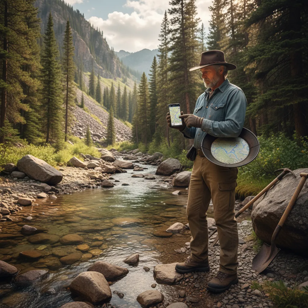
The GoldFever App
This is what I use now. The GoldFever app overlays BLM mining claim data directly on the map so you can see claim boundaries relative to your GPS position. It removes the guesswork. I wish I’d had it before my ranger encounter on Clear Creek.
You can also look at abandoned mine locations on the map, which often indicates areas with historical production — and sometimes unclaimed ground between old workings. Some prospectors combine claim research with metal detecting around old mines to find overlooked deposits near historical workings.
In the Field
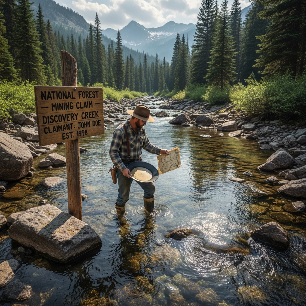
Even with digital tools, look for physical signs:
- Posted signs or claim markers (PVC pipes, rock cairns with paper inside)
- Survey monuments — metal caps in the ground or on rock outcrops
- Fresh digging or equipment — someone’s working there
- Flagging tape tied to trees or brush
If you see any of these and you’re not sure, move on. There’s always more public ground.
Private Land vs. Public Land
Private land is simple: you need written permission from the landowner. Period. Verbal permission is technically sufficient but if something goes sideways, you want paper.
How to tell if land is private:
- Fencing (obvious, but not all private land is fenced)
- Posted signs (no trespassing, private property)
- County assessor websites — most counties have online parcel maps that show ownership
- OnX Hunt or similar apps — these show land ownership overlays and are worth the subscription if you prospect regularly
Public vs. private isn’t always obvious, especially in the West where private parcels are scattered through federal land like a checkerboard. The old railroad land grants created this mess, and it persists today. I’ve walked from BLM land onto private land without realizing it because there was no fence, no sign, nothing but an invisible line on a map.
Common Gold Panning Law Violations That Get People Fined
Panning on an active claim: The most common mistake. Always check. Even creeks that “look public” might have claims filed on them. The claim holder has exclusive mineral rights even on public land.
Using motorized equipment without permits: Hand panning is almost universally legal under casual use. The moment you add a motor — dredge, highbanker, pump — you need permits. The jump from “casual use” to “permitted activity” is significant.
Ignoring seasonal restrictions: Many waterways have seasonal closures for fish spawning. These are enforced, especially in California, Oregon, and Montana. A dredging violation during salmon spawning season is not a warning — it’s a fine, and possibly equipment seizure.
Disturbing the stream bank: Digging into banks, moving boulders with equipment, or diverting water flow goes beyond casual use. If you’re doing more than scooping gravel from the streambed, you might be over the line.
National Park confusion: Some people assume that because an area has public access and is “government land,” it’s okay to pan. National Parks, National Monuments, and some Wilderness Areas prohibit mineral extraction. Know the land designation, not just that it’s public.
My Advice
I’ve been prospecting for a few years now and I’ve never gotten an actual fine. But that ranger encounter on Clear Creek was a wake-up call. I was doing everything right technique-wise — panning correctly, reading the creek, finding color — and I was still in the wrong because I hadn’t checked the claims.
Here’s what I do now before every trip:
- Check the GoldFever app for claims in the area I’m planning to visit
- Verify the land ownership — BLM, Forest Service, state, or private
- Look up any local restrictions — seasonal closures, permit requirements, waterway-specific rules
- Bring a printout or screenshot of the relevant regulations on my phone. If a ranger asks, I can show I did my homework
It takes maybe fifteen minutes of research before each trip. That’s nothing compared to the hours you’ll spend at the creek. And it means when a ranger walks up — which has happened to me twice more since Clear Creek — I can show them exactly where the claim boundaries are and that I’m on the right side of them. Both times, the ranger nodded, said something like “appreciate you checking,” and walked off.
That’s how you want those conversations to go. Trust me.