Published
- 16 min read
Gold Panning in Colorado: 7 Best Spots (With Mine Data)
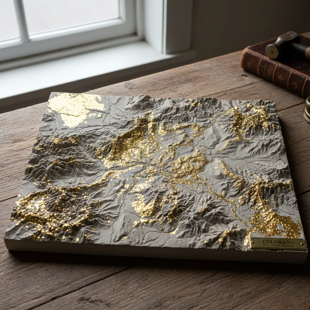
Gold panning in Colorado is some of the best recreational prospecting in the western US — and the numbers back it up. The USGS has documented 6,088 gold-bearing sites across the state, making Colorado the 4th-ranked state in America for gold occurrences. I’ve spent years working these creeks with numb hands and a stupid grin. Here are seven spots I keep going back to, backed by real mine data from the GoldFever.app database.
Colorado’s Gold: 6,088 Sites by the Numbers
Before I get into specific spots, here’s what makes Colorado special for prospectors. I spent over a year importing the USGS Mineral Resources Data System into the GoldFever.app mine map — here’s what Colorado looks like:
| Category | Count |
|---|---|
| Total Gold Sites | 6,088 |
| Active Producers | 401 |
| Past Producers | 4,084 |
| Prospects | 109 |
| Occurrences | 1,007 |
That’s 4,084 past-producing gold mines — places where someone actually pulled gold out of the ground commercially and then moved on. Many of those old workings shed material downstream into the creeks I pan today. For the full state-by-state breakdown, see my gold mines by state data analysis — Colorado’s numbers put it ahead of Arizona, Oregon, Montana, and Idaho. It’s one of the best gold prospecting locations in the USA for a reason.
Colorado’s gold concentrates in several key regions:
- San Juan Mountains (Silverton, Ouray, Telluride): The densest cluster of polymetallic mines in the state — gold, silver, copper, lead, and zinc from secondary hydrothermal venting.
- Clear Creek / Idaho Springs corridor: Historic mining district with the easiest access from Denver.
- South Park / Fairplay area: Placer deposits in Beaver Creek, Tarryall Creek, and surrounding drainages.
- Breckenridge / Summit County: Home to some of Colorado’s largest historical placer operations and dredge workings.
- Silverthorne / Keystone cluster: Dense concentration of named mines — Rattler, Little Fontleroy, Fairview — dating to 1924 Goldfield Mining Company records.
- Front Range foothills: Alluvial gold washing down from the Rockies into metro-area drainages.
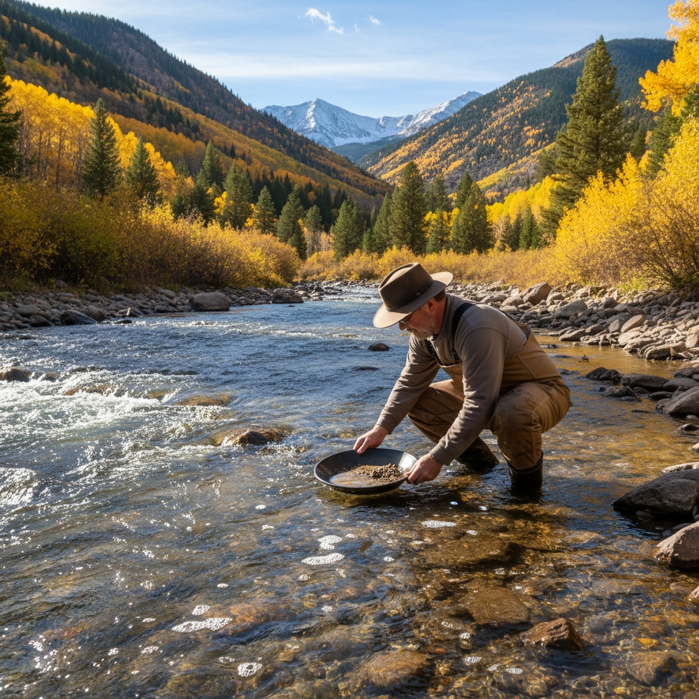
1. Clear Creek at Idaho Springs
If you only pan one Colorado creek, make it this one. Thirty minutes from Denver on I-70, park near the Welcome Center — the lot with the mural of the miner on the wall — and walk upstream maybe a quarter mile. Look for exposed bedrock on the inside bends.
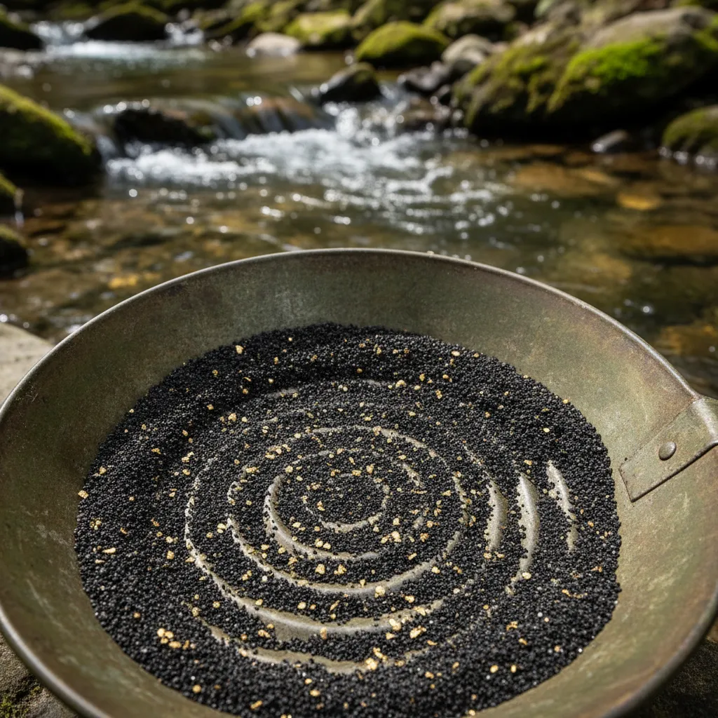
I’ve never been skunked at Clear Creek. Never. The gold is fine placer gold, so you absolutely need a snuffer bottle. I went through two cheap ones from Amazon that either wouldn’t squeeze properly or had tips too narrow to pick up anything before I landed on a Pro-Line snuffer. Eight bucks, works perfectly. I don’t know why I messed around with the others.
My best day here was last September. There’s a bedrock crevice about a quarter mile upstream from the footbridge that I’d walked past probably a dozen times. Unremarkable looking — maybe two inches wide, running diagonal to the current. Something made me stop and clean it out with a flat-head screwdriver. Three pans, about 0.3 grams total. I was so locked in on that crevice that I completely missed the thunderstorm building behind me. Didn’t notice until rain was running down my neck and the lightning was close enough that I could feel the static. Packed up in about ninety seconds flat. Drove home in wet jeans, heater blasting, still grinning. Worth it.
The downside with Clear Creek is summer weekends. It gets crowded — families tubing, other prospectors working the obvious spots. September through October is the sweet spot. The crowds clear out, the water drops, and you can access bedrock that was submerged all summer.

2. South Boulder Creek Near Rollinsville
South Boulder Creek has an interpretive site near Rollinsville that’s perfect for beginners or anyone who wants a designated prospecting area without worrying about claims. It’s about a two-hour round trip from Denver — budget $10–20 in gas.
The gold here is fine — expect micro flakes, not nuggets. A sluice box setup helps enormously. One prospector documented getting about $2 worth of gold from four full buckets of material processed over a full day. That’s not retirement money, but it’s real gold from a real creek, and the site is legal and well-marked.
Pro tip: Water levels matter here more than most spots. In record-high water years, the creek can submerge the best crevicing spots entirely. Classify your material through a quarter-inch screen before sluicing — it prevents jams and helps the sluice catch more fine gold. Adding a drop of Jet Dry (dish rinse agent) to your pan breaks surface tension so flour gold can’t float away during the final stages.
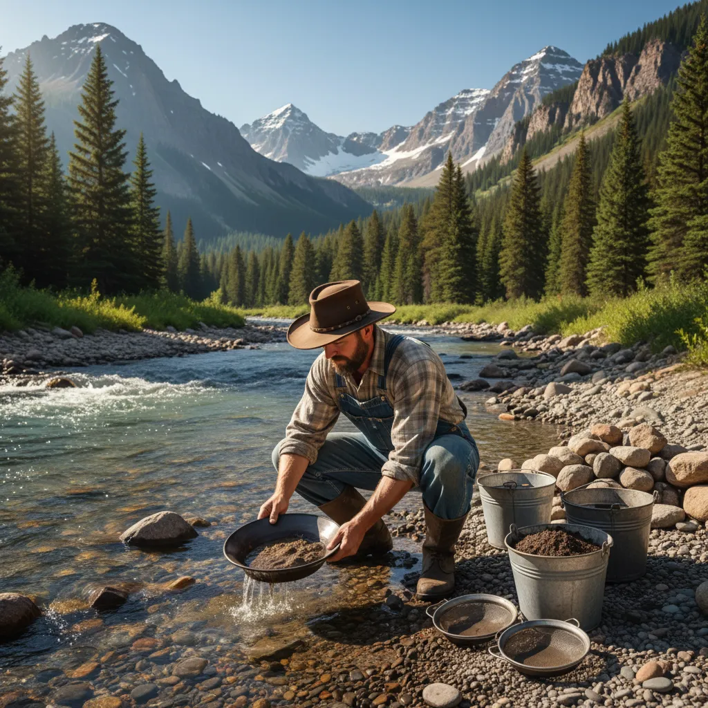
The key technique at South Boulder Creek — and really any Colorado creek — is sample panning first. Dig one shovelful from three different spots, pan each separately, and count the gold colors per pan. Then commit your time to the richest spot. This simple step has probably doubled my daily yield compared to when I used to just pick a spot and start digging randomly.
3. Beaver Creek Near Fairplay
About ninety minutes from Denver. Worth the drive if you want fewer people and slightly coarser gold than Clear Creek. I’ve found flakes near where the creek crosses Forest Road 659 that I could actually pick up with tweezers instead of needing a snuffer. That’s rare in Colorado.
Check the GoldFever.app map for active claims before you go — they’re scattered through the drainage and you don’t want to set up on someone else’s ground. I learned this the diplomatic way (a polite conversation with a claim holder who pointed me downstream), not the hard way (getting yelled at), but I’ve heard stories about the hard way and they’re not fun.
My buddy Marcus grew up in Fairplay. He told me the old-timers called Tarryall Creek “Grab-all” because the early miners were so possessive of their claims. I have absolutely no idea if that’s true or if Marcus made it up, but I choose to believe it because it’s a great story. Marcus has been prospecting since he was twelve and he knows every creek in South Park better than I know my own neighborhood. When he says “try behind the big granite boulder in the lower stretch,” you try behind the big granite boulder. Last time I listened to him I pulled out a flake big enough to see without reading glasses — nice bright yellow, not the pale stuff you sometimes get from oxidized material.
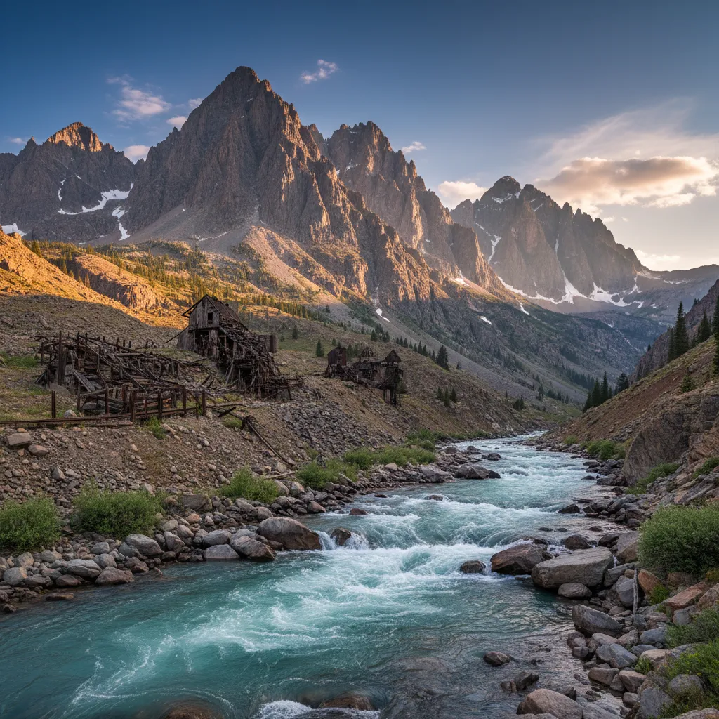
4. The Animas River Near Silverton
This is the spot for people who want their gold prospecting to come with an adventure.
The drive over Red Mountain Pass — part of the Million Dollar Highway from Durango — is genuinely beautiful and genuinely terrifying. Switchbacks with no guardrails, peaks hitting 13,000 feet, and drops that your brain refuses to process as real. I white-knuckled it the first time. Now I barely notice, which probably means I should be more concerned, not less.
The Animas between Silverton and Howardsville has some of the coarsest placer gold in Colorado. I’ve found pieces here that were actually chunky. Not nuggets exactly, but substantial enough that my tweezers got a real workout. The geology explains why — the San Juan Mountains host polymetallic deposits with gold, silver, copper, lead, and zinc from secondary hydrothermal venting. That concentrated mineralization means the placer gold downstream tends to be coarser and richer than what you find along the Front Range.
The trade-off is that you earn it. Elevation above 9,000 feet. Water so cold your hands go numb in ten minutes even with neoprene gloves. And afternoon thunderstorms that roll in like clockwork around 2 PM — I’ve seen it go from sunny and 70 to hailing in under an hour.
Fair warning: mining claims and abandoned mine sites dot the whole drainage above Silverton. Check before you set up anywhere. And stock up on supplies in Durango or Ouray before you head in. Silverton has limited options and premium prices. Also be aware of the Gold King Mine environmental situation — an EPA breach of the internal tailings dam sent contaminated material down the Animas River, so avoid the immediate area around that site.
5. Tarryall Creek
I’ve only been to Tarryall twice, so I’m not going to pretend I know it as well as Clear Creek. But both trips produced color and I barely saw another person, which is increasingly rare in Colorado.
Access is off Highway 77 south of Jefferson. There’s a dirt pulloff where the road crosses the creek — you’ll see it, there’s usually a busted-up fire ring nearby. From there I walked downstream maybe half a mile to where the creek makes a sharp S-bend through some willows. That inside bend had a nice gravel bar with dark concentrates visible even before I started panning.
First trip was October 2024 with Marcus. Water was low, maybe ankle-deep in the deepest runs. We worked a stretch of about fifty yards and both came away with fine gold — nothing you’d brag about, but consistent color in every pan. The kind of day where you think “I bet this place really produces in spring runoff years when heavier material gets deposited.” Marcus pointed out some old hand-stacked rock piles along the bank that looked like they’d been there since territorial days. Whether that means the old-timers found good gold here or just found good hope, I can’t say.
Second trip I went alone the following summer. Higher water, harder to work. I moved upstream toward the national forest boundary and found a spot where a side drainage enters the main creek. The junction had a natural riffle that trapped material. Pulled some of the brightest gold I’ve seen in Colorado out of there — that deep yellow color you get from gold that hasn’t traveled far from the source. Three or four nice flakes plus the usual fine stuff. I keep meaning to go back and work that junction more thoroughly, but something else always comes up.
If you’re looking at Tarryall, it’s worth understanding how to read a river for gold — the creek doesn’t have obvious bedrock traps like Clear Creek, so knowing where material settles in a gravel-bottom stream makes a real difference.
6. Arapaho Bar
Arapaho Bar is one of Colorado’s better-known designated prospecting areas, documented in the book Finding Gold in Colorado. The site produces flood gold — material deposited by water flow during high-water events — and multiple prospectors report finding color in every pan on the north bank.
Important rules at Arapaho Bar:
- Do NOT dig on the south bank (the side with the walking path) — this is clearly signed at the site
- Digging is permitted on the north bank of the creek only
- Always check current signage when you arrive, as regulations can change
When scouting a spot here, look for high ground near the river — these are good indicators of where flood gold accumulates. Dig near and under larger rocks, especially ones with material growing underneath them. The prospecting community at Arapaho Bar tends to be friendly and knowledgeable — regulars share tips about productive spots freely. Be a good ambassador for the hobby by following the posted rules. Sites like this stay open because prospectors respect the boundaries.
Practical approach: Dig two buckets of dirt from a single promising spot and test pan before committing to extended digging. If you’re getting color, stay put. If not, move to another spot on the north bank and repeat. This systematic test-panning approach works better than randomly digging wherever looks good — it’s the same technique that works in any river.
7. Pueblo Reservoir
Below the dam at Pueblo Reservoir is a spot that doesn’t get much attention from the Colorado prospecting community, but it produces. The gold here is micro flour gold — extremely fine specks that require patience and good panning technique to recover.
Prospectors have reported finding 10–20 micro specks per pan from material near large rocks, plus additional small flakes from behind submerged boulders in the riverbed. You’ll also find abundant black sand, small red garnets, and quartz — some with gold still attached.
Where to dig at Pueblo:
- Scout below the dam on an inside bend of the river
- Look for large rocks with material trapped behind them (natural riffles)
- Dig dry material near large rocks that has “dropped out” on the bank
- Behind flat rocks in the riverbed — material collects there even in swift current
The key principle here — and everywhere in Colorado — is that gold settles where it can, as soon as it can. When water velocity drops, gold goes to the bottom immediately. Inside bends, behind rocks, anywhere the current slows — that’s where you concentrate your effort.
Where NOT to Bother in Colorado
Not every part of Colorado has gold, and knowing where to skip saves you a wasted trip.
The Eastern Plains: Almost no gold exists east of the Front Range. The flat, dry rangeland east of I-25 is dominated by oil production and agriculture. You might find the occasional speck of flour gold that washed down from the Rockies millions of years ago, but it’s not worth a dedicated trip. If someone tells you about a great spot on the plains, they’re either confused or messing with you.
Denver metro gravel pits: Some commercial sand and gravel operations near Denver have historically produced gold as a secondary output from alluvial deposits. But these are private commercial operations — you can’t walk in and start panning. The gold in metro-area waterways is real (it washes down from the Rockies), but it’s flour gold spread thin across enormous drainages. Head to the mountains instead.
Is Gold Panning in Colorado Legal?
Short answer: yes, on public land with hand tools. Here are the specifics:
- National Forest and BLM land: You’re good with a pan and hand tools. No permit needed for recreational panning. Don’t use motorized equipment, and check for active mining claims first.
- Designated prospecting areas (like Arapaho Bar): Follow posted rules exactly — they exist to keep these areas open for everyone.
- State Parks: Generally no. Don’t try it unless you’ve specifically confirmed it’s allowed.
- Private land and mining claims: Not without permission. Period.
Colorado is actually one of the more accessible states for recreational panning. The Colorado Parks & Wildlife site has land-status maps that help you confirm whether you’re on public ground, and the rules vary depending on land management. I wrote a full breakdown of gold panning laws by state if you want the details for Colorado and neighboring states like Wyoming and New Mexico.
Fill your holes, don’t mess with stream banks, pack out your trash. These aren’t just suggestions — they’re what keeps recreational prospecting legal in Colorado.
Best Time to Go Gold Panning in Colorado
Skip spring entirely. Snowmelt from April through June turns every creek into a washing machine. I’ve tried it. Spent more time fighting current than panning and came home with nothing but sore legs.
Late summer through fall — August to October — is prime time. Water levels drop, bedrock gets exposed, weather is still warm enough to enjoy yourself. September is my favorite month, no question.
Month-by-month breakdown:
| Month | Verdict | Notes |
|---|---|---|
| April–June | Skip it | Snowmelt makes most creeks unworkable and dangerous |
| July | Possible | Lower elevations work, mountains still high water |
| August | Great | Water dropping, bedrock appearing, warm days |
| September | Best month | Low water, exposed bedrock, fewer crowds, perfect weather |
| October | Great | Low water continues, fall colors, cooling temps |
| Nov–March | Accessible spots only | Clear Creek works year-round from the highway, but it’s miserable |
I’ll occasionally pan Clear Creek in winter since it stays accessible from I-70, but honestly the gold doesn’t migrate. It’ll still be there in August.
Essential Gear for Colorado’s Cold Water
This might be the most important section in this article. Colorado water is snowmelt year-round and it does not care about your enthusiasm.
Neoprene gloves. I’m not going to list this as “recommended.” It’s mandatory. Get 3mm dive gloves. They’re fifteen bucks and they’re the difference between panning all day and giving up by noon because you can’t feel your fingers.
Waders if you’re serious. Hip waders are fine for most spots. The best material is often in the active channel and you can’t reach it from the bank without getting soaked.
A quarter-inch classifier. Classify your material before panning or sluicing. This removes oversized rocks and lets you process material faster. It’s especially critical if you’re running a fluid bed sluice — unclassified material jams the riffles.
Snuffer bottle. Colorado gold is mostly fine. Without a snuffer, you’ll leave half your gold in the pan. Get a Pro-Line — skip the cheap Amazon options.
Layers. Mountain afternoon thunderstorms are daily events in summer. I keep a rain jacket and dry shirt in my pack after the Clear Creek thunderstorm incident taught me that lesson.
For a complete rundown of what to bring, check my gold panning equipment guide.
What to Expect Gold Panning in Colorado
You’re not going to get rich. The days of scooping nuggets out of Clear Creek ended 150 years ago.
But you will find gold. Real gold. I’ve never had a completely skunked trip in Colorado. Even my worst days produce a few specks of color that I can see in the pan. On a good day at a productive spot, maybe half a gram. A really good day, a full gram. That’s not retirement money, but it’s gold I found myself in a mountain stream with the Rockies all around me.
Here’s what the data tells us about why Colorado is so consistent: of those 6,088 gold sites in the USGS database, 4,084 are past producers — mines that actually extracted gold commercially. Those old workings continuously shed material into downstream drainages. Every spring runoff washes a little more gold out of the mountains and into the creeks you’ll be panning. The gold isn’t running out; it’s being replenished by geology that’s been working for millions of years.
The first time you see color in your pan up here, you’ll do what I did — grin like a moron, take a blurry photo, and immediately text someone who doesn’t care.
Start Prospecting Colorado
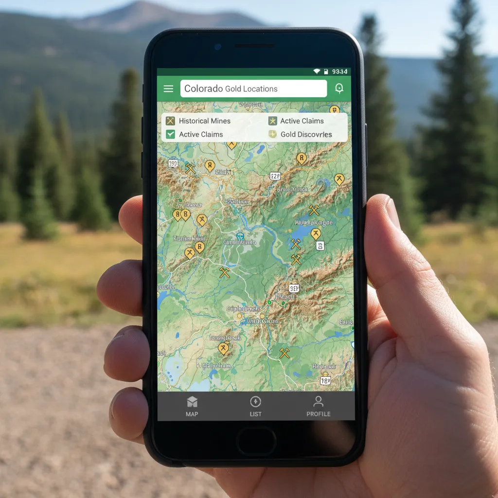
New to panning? Start with my beginner’s guide to gold panning and my complete guide to gold mining techniques. Want to explore Colorado’s 6,088 gold sites on an interactive map? Download GoldFever.app and start planning your next trip.
Looking beyond Colorado? I’ve written about California’s gold country, Arizona prospecting, Georgia’s gold belt, North Carolina’s historic districts, and where gold is found across the US.