Published
- 19 min read
Where is Gold Found in the US? 74,805 Sites Mapped

So where is gold found in the United States? There are 74,805 documented gold-bearing sites across 37 states in the USGS Mineral Resources Data System — and I know that sounds like something I made up. But I went through USGS databases and state geological surveys for the better part of a year building the GoldFever.app mine map, and the numbers kept surprising me. People email me all the time saying they had no idea there was a documented gold mine twenty minutes from their house. A guy in Maine. Someone in Michigan. Texas, even. (I compiled gold mine counts for every state if you want the raw data.)
Short answer: Gold is concentrated in five major US regions — the Sierra Nevada (California), the Great Basin (Nevada), the Rocky Mountains (Colorado/Montana/Idaho), Alaska, and the southern Appalachian belt (Georgia/Carolinas). Nevada produces roughly 70% of US gold by weight per USGS Mineral Commodity Summaries 2025. California, Alaska, and Colorado round out the top four. But recreational gold has been documented in 37 states.
Open the interactive map → goldfever.app/map — type your state, see every documented mine within 50 miles. I built this because I was tired of looking up USGS coordinates by hand. It’s free.
The western US is one of only five major gold concentrations on the entire planet — alongside southern Australia, China, South Africa, and Peru. California and Nevada alone have produced roughly 210 million ounces of gold between them. That’s nearly one-tenth of all gold ever recovered by humans.
But state-level lists are boring and you can find those anywhere. Let me just tell you what I know from actually putting a pan in the water.

Top 10 Gold-Producing States (2024 USGS Data)
Before I dive into the regions I actually pan in, here’s the production reality per the USGS 2025 Mineral Commodity Summaries (I also compiled historical gold production by state going back to the first strikes, if you want the long view):
| Rank | State | % of US Production | Primary Districts | USGS Sites |
|---|---|---|---|---|
| 1 | Nevada | ~70% | Carlin Trend, Cortez, Round Mountain | 7,682 |
| 2 | Alaska | ~16% | Fort Knox, Pogo, Donlin | 8,177 |
| 3 | Colorado | ~3% | Cripple Creek, Clear Creek | 6,088 |
| 4 | Utah | ~3% | Bingham Canyon (byproduct) | 1,820 |
| 5 | California | ~2% | Mesquite, Sierra Nevada | 23,872 |
| 6 | Arizona | ~1% | Cu byproduct, Lynx Creek district | 5,051 |
| 7 | Montana | <1% | Stillwater, Helena district | 3,154 |
| 8 | South Dakota | <1% | Wharf, former Homestake | 488 |
| 9 | Washington | <1% | Republic, Buckhorn | 1,624 |
| 10 | Idaho | <1% | Boise Basin, Stibnite | 4,468 |
Two things jump out. First, Nevada totally dominates current production but California has three times the documented historical sites. Second, the production list and the “good places to recreationally pan” list are completely different. Nevada is industrial open-pit microscopic gold. The states where you can actually pan a creek and find something are California, Colorado, Alaska, Oregon, Arizona, and the Appalachian belt.
California — The Mother Lode
California has 23,872 USGS-documented gold sites — more than any other state by a factor of three. I could write five thousand words about California gold and my wife would still have to physically stop me, so I’ll keep this shorter than I want to.
The Mother Lode is real, it’s still producing, and it’s not even close to empty. The lode itself is a 120-mile, north-south quartz vein system running through the western foothills of the Sierra Nevada from Mariposa to Auburn. Forty-niners extracted an estimated 70 million ounces of river gold from California’s streams and ancient riverbeds, then blasted another 35 million ounces from quartz veins in the Sierra Nevada. And geologists estimate somewhere between 80-90% of the original gold has never been recovered. The forty-niners got the easy stuff — nuggets sitting in creek beds, chunks falling out of exposed quartz veins — and then they moved on to the next gulch. They were in a rush. It was literally called a rush.
California’s gold concentrates in four main geological zones documented by the California Geological Survey: the Sierra Nevada Mother Lode, the Klamath Mountains (rich in both gold and platinum), the Coastal Ranges, and Southern California’s desert placers. The only area with minimal gold is the Central Valley, buried under miles of sediment. It’s genuinely hard to go anywhere in California and not be near some kind of gold opportunity — the Pacific plate subduction zone pushed gold into the upper crust across nearly the entire state.
I drove up to Coloma in March 2024 to pan the South Fork American River, the same stretch where James Marshall kicked off the whole thing in 1848. Rented a cabin outside town that smelled like pine cleaner and had one working burner on the stove — I ate cold sandwiches for two of the three days because I couldn’t be bothered to figure out the propane situation. The water was muddy from overnight rain, which almost made me bail, but I figured I’d already driven six hours.
Fourth pan. Tiny line of yellow sitting right on the riffle of my Garrett pan. My hands were shaking from the cold so bad I nearly dumped it trying to get the snuffer bottle positioned. Three days total, about 2 grams of fine gold. Nothing life-changing but absolutely enough to keep me coming back.
The Yuba River system is where I’d actually send someone who wants fewer crowds and coarser gold. A guy named Tom I met at a Sacramento prospecting club meeting has been working the North Yuba below Downieville for thirty years. He told me the American River is “where tourists go” and the Yuba is “where prospectors go.” I thought he was being elitist until I hiked into a Yuba canyon and didn’t see another person for six hours. Tom might be right.
I wrote a full breakdown of California spots — the Mokelumne, Woods Creek near Jamestown, the Feather River, all of it — plus a step-by-step guide to gold panning in California covering claims, seasons, and specific access points.
Nevada — The State Nobody Pans
Here’s a fact that annoys California prospectors: Nevada produces about 70% of all US gold per the USGS 2025 Mineral Commodity Summary. More than any other state by a massive margin, with 7,682 documented gold sites in the USGS database. The Carlin Trend alone — a 50-mile-long, 5-mile-wide crack in the earth near Elko — has yielded 65 million ounces of gold. That single geological feature made the US the fourth-largest gold producer in the world.
The Great Basin geological province that covers most of Nevada is the reason. Carlin-type deposits are sediment-hosted, with gold so fine you literally cannot see it — it’s chemically bound up in pyrite at a few parts per million. The catch is it’s almost entirely industrial-scale mining. Microscopic gold in massive open pits. Hot spring deposits across Nevada have produced over 40 million ounces of gold and 500 million ounces of silver. I drove past the Barrick operation near Elko once and it looked like they’d removed an entire mountain range. Just a void where geology used to be. Impressive and genuinely unsettling at the same time.
I haven’t done much recreational prospecting in Nevada and I feel like I’m leaving gold on the table. A retired BLM geologist named Phil that I met at the Tucson gem show a couple years back told me the best recreational panning is in the unnamed creeks draining the Tuscarora district north of Elko. “Nobody goes up there because nobody knows about it,” he said. Phil had the kind of sunburn that suggested he knew what he was talking about. I haven’t verified his tip yet but it’s high on my list.
Colorado — Cripple Creek and the Front Range
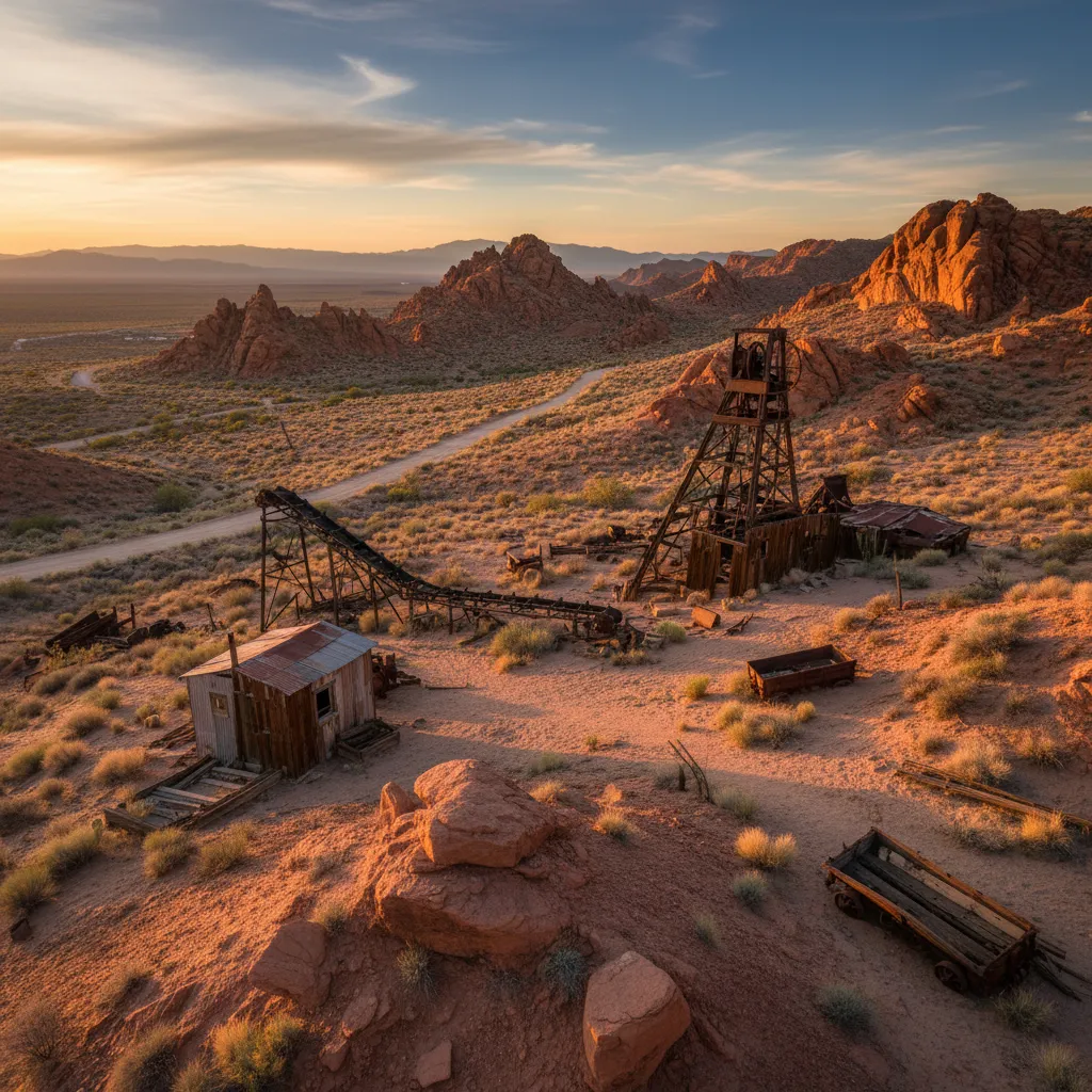
Colorado has 6,088 USGS-documented gold sites — fourth in the nation — and some of the most accessible panning in the West. Cripple Creek south of Pikes Peak is the geological headline: a single Tertiary-age volcanic diatreme that has produced over 23 million ounces and is still actively mined today. The Colorado Mineral Belt — a southwest-trending corridor of mineralization that runs roughly from Boulder through Leadville to the San Juans — accounts for the vast majority of the state’s gold.
For recreational panning, Clear Creek near Idaho Springs is my pick. Thirty minutes from Denver, runs right through town, documented gold, and I have never been skunked there. Not once. The gold is fine — you need a snuffer bottle, I use a Pro-Line with the wider opening — but it is consistent. My buddy Marcus, who grew up in Fairplay, says the South Park district has coarser gold with fewer people, and he’s not wrong. I’ve found flakes near Beaver Creek that I could actually pick up with tweezers.
The San Juans around Silverton are a different animal entirely. Higher elevation, colder water, wilder terrain, but the gold is chunkier than anything on the Front Range. I cover my favorite Colorado panning spots in another article.
Alaska — Beach Gold and the Yukon-Tanana
Alaska has 8,177 USGS-documented gold sites and produces about 16% of US gold today, making it second only to Nevada. The geological story is the Yukon-Tanana terrane — ancient continental crust that got jammed onto the North American plate hundreds of millions of years ago, full of metamorphosed gold-bearing veins. The Fairbanks district alone has produced over 14 million ounces.
The wildest thing about Alaska gold is Nome. The beaches at Nome are gold beaches. Wave action concentrates fine placer gold in the black-sand layers above the high tide line, and the recreational mining area west of town is open to anyone — no claim required, no permit, just a shovel and a pan. I haven’t made it there yet but it’s on my bucket list. Everyone says go in August, bring layers, plan for a week. It’s competing with a kitchen renovation for my vacation budget and my wife has strong opinions about which one happens first.
The Eastern Gold Belt — Where American Gold Was First Found
This is the part of US gold history that nobody talks about, and I don’t fully understand why. America’s gold industry started in the Southeast, not the West. The Appalachian gold belt runs from Alabama up through Georgia, the Carolinas, Virginia, Maryland, into Vermont and Maine. The geological feature is the Carolina Slate Belt and the Piedmont — ancient volcanic arc rocks that got accreted onto North America back when Pangea was still a draft.
North Carolina — Where It Started in 1799
North Carolina has 591 USGS-documented gold sites and had the first documented gold find in the US — a 12-year-old named Conrad Reed found a 17-pound nugget on his family’s plantation in 1799, used it as a doorstop for three years, then sold it for $3.50 because the family had no idea what it was. The state led the nation in gold production for nearly fifty years until California stole the spotlight in 1848.
The Carolina Slate Belt runs from southern Virginia down through North Carolina’s Piedmont into South Carolina. I’ve talked to guys pulling decent color out of creeks in Cabarrus and Mecklenburg counties. The Uwharrie National Forest allows panning with a free permit, and Reed Gold Mine runs a tourist operation where the real gold in the pan is real gold. I wrote a full guide to North Carolina gold panning with specific creek locations and permit details.
Georgia — Dahlonega and the 1828 Rush
Dahlonega is the one that blows people’s minds. Georgia has 503 documented gold sites and America’s first actual gold rush happened there in 1828, twenty years before California. The Federal Mint at Dahlonega struck more than $6 million in gold coins between 1838 and 1861. I drove down from Nashville, panned the Chestatee River in my Chacos like a fool, and found colors on my first pan. The whole Appalachian gold belt from Georgia through the Carolinas into Virginia has documented deposits and gets almost no prospecting pressure. If I lived in the Southeast I’d be out there every weekend instead of buying plane tickets to Sacramento. I wrote up my favorite Georgia panning spots separately.
Virginia, Vermont, and Maine — The Forgotten Belts
Virginia has documented gold across the Virginia Gold-Pyrite Belt running through Spotsylvania, Goochland, and Buckingham counties. The state produced over 100,000 ounces in the 19th century. Vermont has gold in the Connecticut River drainage, with Plymouth and Bridgewater being the historic centers — the Vermont Geological Survey publishes a free gold-panning map for tourists. Maine has gold in the Swift River near Byron and in Sandy River drainages; the Coos Canyon recreational area allows free panning.
None of these states will make you rich. But the gold is documented, the creeks are accessible, and the prospecting pressure is basically zero. If you live east of the Mississippi, your closest documented gold is almost certainly closer than you think.
How Gold Got There: Placer vs. Lode Deposits
Knowing where gold concentrates geologically helps you stop wasting weekends. There are two major types of US gold deposits:
Lode deposits are gold in its original host rock — quartz veins, sulfide ores, or sediment-hosted ore bodies. These form when superheated hydrothermal fluids deposit gold from solution into cracks in the surrounding rock. The Mother Lode in California, the Carlin Trend in Nevada, and the quartz veins of the Appalachian Slate Belt are all lode deposits. Lode mining requires hard-rock excavation and is mostly the domain of commercial operations.
Placer deposits are gold that has eroded out of its original host rock and concentrated in stream beds, ancient riverbeds, or beach sands. This is what recreational prospectors look for. Placer gold is denser than the surrounding gravel by a factor of 19, so it sinks to bedrock and collects in specific predictable spots — inside river bends, behind boulders, in bedrock crevices, on the upstream side of obstructions. I wrote a full article on what placer gold is and where it collects if you want the geology behind why these spots work.
Almost every famous US gold region has both. The Sierra Nevada has the Mother Lode (the lode) and the rich placer creeks below it (the placer). The Appalachian belt has the slate-hosted quartz veins (lode) and the creeks draining them (placer). When you’re planning a recreational trip, you’re almost always after placer gold downstream of historic lode workings.
How to Find Gold Near You (Using the Gold Fever App)
Here’s the workflow I use when planning a trip:
- Open goldfever.app/map. Type in your state or zoom to your region.
- Filter by status. Active and historical mines are clustered with red and gold markers. I usually look for clusters of historical placer sites along major drainages.
- Find a creek downstream. Gold doesn’t travel uphill. If you see a cluster of documented lode mines on a hillside, the creek draining that hillside is where placer gold collected.
- Cross-check public-land status. BLM and USFS land allows recreational panning in most western states. Check the legal-status guide for your specific state.
- Drive there. Pan. Don’t overthink it.
This is the workflow that took me from “researching gold for six months” to “actually finding gold on the first trip.” A free GPS-aware map of 74,805 documented sites is the tool I wish I had when I started. So I built it.
What to Look For Once You Pick a Spot
Knowing the state doesn’t help if you’re digging in the wrong part of the creek. Gold is 19 times denser than water, which means it behaves totally differently than everything around it. It sinks through gravel until it hits bedrock. It drops out of the current wherever water slows down — inside bends, behind boulders, anywhere the channel widens. I go deep on how to find gold in rivers and streams in a separate article.
Bedrock crevices are the jackpot. Old tailings piles near historic mines are underrated. And any time you see a change in gravel color — a layer of black sand especially — that’s heavy mineral concentration and gold is often right there with it. When you do find something shiny, make sure you know how to tell real gold from pyrite before you get too excited.
The mining technique you use matters as much as where you prospect. Panning works for sampling, but running a sluice box or metal detecting will move more material and find gold that panning misses — especially nuggets buried deeper than a pan can reach. If you’re near historic workings, metal detecting around old mines can turn up specimens the original miners missed.
Quick Reference: Major US Gold Regions
| Region | Top States | USGS Sites | Gold Type | Best For |
|---|---|---|---|---|
| Sierra Nevada | California, Nevada | 31,554 | Placer & lode | Year-round panning, coarse gold |
| Rocky Mountains | Colorado, Montana, Idaho | 15,325 | Placer & hard rock | High-elevation summer panning |
| Pacific Northwest | Oregon, Washington | 8,268 | Fine placer | River panning, dredging where legal |
| Alaska | Nome, Fairbanks | 8,177 | Beach & placer | Bucket-list adventure panning |
| Desert Southwest | Arizona, New Mexico | 6,355 | Placer & nuggets | Winter prospecting, metal detecting |
| Appalachian Belt | Georgia, Carolinas, Virginia | 1,819 | Fine placer gold | Uncrowded creeks, historic sites |
Other States Worth Knowing About
Lynx Creek near Prescott, Arizona is my winter escape. Arizona has 5,051 USGS-documented gold sites — fifth in the nation — and the Forest Service set up a designated panning area at Lynx Creek, which removes all the “am I allowed to be here” anxiety. Fine gold, beautiful weather in January, and one time a rattlesnake sunning itself on the access trail that took about five years off my life. I cover Arizona’s best panning spots including Lynx Creek and the Rich Hill district in a separate guide.
Oregon (4,829 USGS sites) and Idaho (4,468 sites) round out the Pacific Northwest gold story. Southern Oregon’s Rogue River and Galice Creek produced heavily during the 1850s and still give up fine gold to anyone willing to work the inside bends. Idaho’s Boise Basin was one of the richest placer districts in the entire West — $250 million in gold came out of there in nineteenth-century dollars. I haven’t prospected Idaho yet but a friend who works a claim near Idaho City says the tailings piles from dredge operations still produce. Make sure you check gold panning laws for each state before you head out — regulations vary wildly between Oregon, Idaho, and Washington.
States Most People Don’t Think Of
Montana’s gold belt around Helena and Virginia City produced heavily in the 1860s. South Dakota’s Black Hills — sacred Lakota Sioux land — have been mined since the mid-1870s and the Homestake Mine was one of the deepest in the Western Hemisphere. Even states like Michigan, Maine, and Texas have documented gold occurrences, though they’re not exactly destinations you’d plan a prospecting trip around.
The thing that surprised me most building the GoldFever mine map was how many abandoned mines exist in states nobody associates with gold. Old prospect holes, small-scale operations that ran for a season or two, test shafts that never panned out. They’re everywhere.
How Much Gold Is Still Undiscovered in the US?
A reasonable estimate from the USGS Mineral Resource Assessment program puts undiscovered US gold resources at roughly 33,000 metric tons — about three times what has been mined in the country’s history. The vast majority of that is in Carlin-trend-style sediment-hosted deposits in Nevada that only commercial operations can extract.
For recreational prospectors the more interesting number is this: roughly 80-90% of placer gold in the famous California, Colorado, and Alaska districts was never recovered. The forty-niners had pans and shovels. Modern prospectors have metal detectors that find gold below the surface and detect down to bedrock crevices the original miners couldn’t reach. There is real gold in real creeks still. Not enough to retire on. Enough to make weekends interesting.
Frequently Asked Questions
Which state has the most gold in the United States?
Nevada produces the most gold annually — approximately 70% of US production per the USGS Mineral Commodity Summaries 2025. By historical production and documented site count, California leads with over 100 million ounces extracted and 23,872 USGS sites. Alaska is second in current production at roughly 16%.
Where is the best place to find gold in the US?
I rank the best gold prospecting locations in the USA in a dedicated guide, but the top spots by accessibility are: the South Fork American River in California (Coloma area), Clear Creek near Idaho Springs in Colorado, Lynx Creek in Arizona’s Prescott National Forest, the Rogue River drainage in southern Oregon, and the Nome beaches in Alaska. For uncrowded panning, Dahlonega Georgia and the Uwharrie National Forest in North Carolina see very low prospecting pressure.
Can you still find gold in American rivers?
Yes — and not just trace amounts. Recreational prospectors regularly recover measurable gold in California, Colorado, Oregon, Idaho, Alaska, Arizona, Georgia, and the Carolinas. USGS resource assessments suggest 80-90% of original placer gold in major historic districts was never recovered. Modern recovery techniques like high-banking, sluicing, and metal detecting reach gold the forty-niners couldn’t.
What states have natural gold deposits?
The USGS Mineral Resources Data System documents gold occurrences in 37 states. The top-10 by documented site count: California, Alaska, Nevada, Colorado, Arizona, Idaho, Oregon, Montana, Washington, and Utah. Eastern states with significant documented gold include North Carolina, Georgia, Virginia, South Carolina, Vermont, and Maine.
Is gold panning legal on public land?
Generally yes — recreational hand panning is permitted on most BLM and USFS land in the western US without a permit, as long as you stay outside active claims and don’t use mechanical equipment in restricted areas. Rules vary significantly by state and by specific land designation (wilderness, national park, national monument). The state-by-state legal guide covers the specifics for every state with documented gold.
Where in the US is the most gold left?
Per USGS undiscovered-resource assessments, Nevada’s Great Basin holds the largest undiscovered gold resources — estimated at over 33,000 metric tons total nationwide, with the vast majority in Carlin-type sediment-hosted deposits. For recreational prospectors, undeveloped placer districts in Alaska, the upper Yuba and Feather River systems in California, and the Tuscarora district in Nevada remain the most under-prospected accessible areas.
Stop Reading
Seriously. I spent months reading about gold prospecting before I ever put a pan in a creek. Months. It’s the single biggest regret of my hobby. You will learn more in one afternoon of actual panning than in a month of articles, and yes I appreciate the irony of saying that in an article.
My wife says I talk about gold too much at dinner parties. She’s right. I cornered a guy at our neighbor’s barbecue last summer and talked his ear off about bedrock crevices for twenty minutes before she rescued him. But that’s what happens when you find your first flake — you can’t shut up about it.
Pick the closest gold-bearing area to you. Drive there Saturday. If you’re brand new, read the beginner’s guide to gold panning — it’ll take ten minutes — then grab the basic gear and get your pan wet. Or just open the map and see what’s within fifty miles of you right now. The gold has been sitting there for millions of years. It’ll wait until the weekend.