Published
- 22 min read
Gold Panning in Arizona: 15 Spots That Produce

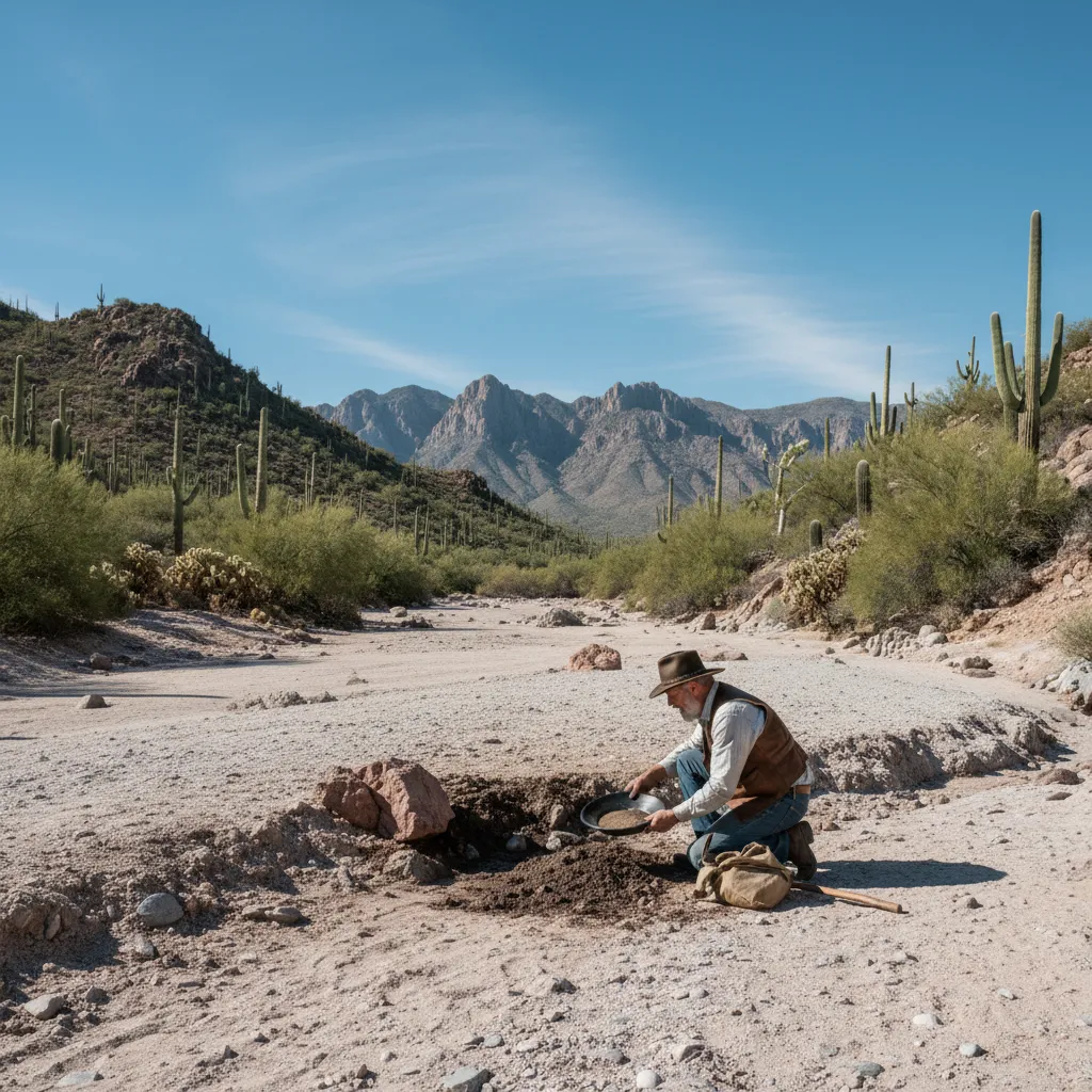
Gold panning in Arizona surprises people. No mountain streams cutting through granite. No green valleys with gravel bars stacked against willows. It’s desert — brown, dry, and hot enough to cook your boots on the rocks from May through September. And yet the USGS has documented over 900 gold-bearing mines across the state, concentrated in a belt running from Prescott down through Wickenburg and into the Bradshaw Mountains. If you think gold panning in Arizona sounds unlikely, you’re not alone — I felt the same way before my first trip.
I went to Arizona expecting fine dust and disappointment. My first trip to Lynx Creek near Prescott changed that. I pulled 0.1 grams in a few hours — including a picker nugget I could see sitting on the clay before I even got it into the pan. Arizona gold is real, it’s accessible, and the state has some of the most beginner-friendly public panning areas in the country.
Here’s everything I’ve learned about gold panning in Arizona — where to go, what’s legal, what gear works in the desert, and when to avoid the heat that can genuinely hurt you.
Why Gold Panning in Arizona Produces Real Results
Arizona’s gold story goes back further than most people realize. Spanish explorers documented gold here in the 1500s, centuries before the California Gold Rush. The Bradshaw Mountains south of Prescott produced millions in gold during the 1860s–1880s, and placers in the Lynx Creek and Hassayampa drainages have been worked continuously for over 150 years.
The geology explains why. Central Arizona sits on a collision zone where ancient volcanic and metamorphic rocks were intruded by gold-bearing quartz veins. Millions of years of erosion — mostly from violent flash floods, not gentle streams — broke those veins apart and spread placer gold across desert washes, creek beds, and hillside deposits. Unlike the Sierra Nevada where gold concentrated in river channels, Arizona gold can show up in unexpected places: hillside colluvium deposited by ancient floods, dry washes that only see water a few days per year, and clay layers that act as false bedrock.
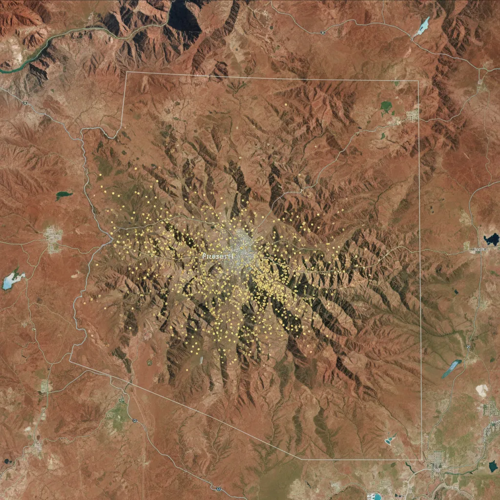
Where is the most gold found in Arizona? The Prescott–Bradshaw Mountains region accounts for the highest concentration of documented gold deposits. The GoldFever.app mine map shows dense clusters around Lynx Creek, Rich Hill, the Hassayampa River, and the Crown King area. The Quartzsite–La Paz region in western Arizona is the other major zone, particularly along the Colorado River placers.
Arizona Gold Panning Laws and Permits (2026)
Before you touch dirt, know the rules. Arizona is one of the more permissive states for recreational prospecting, but the rules change depending on whose land you’re standing on.
BLM and National Forest Land Rules
Do you need a permit to pan for gold in Arizona? No — recreational gold panning on BLM (Bureau of Land Management) and National Forest land does not require a permit in Arizona. You can use a gold pan, hand sluice, or basic hand tools without any special authorization, as long as you’re on open public land with no active mining claim.
The key word is “recreational.” You’re allowed to use:
- Gold pans
- Classifiers and screens
- Hand sluice boxes (on most BLM land)
- Crevicing tools — screwdrivers, spoons, rock picks
- Metal detectors (with restrictions on digging depth)
Sluice box restrictions vary by location. Prescott National Forest’s Lynx Creek Day Use Area prohibits sluice boxes entirely — pans only. Other BLM and Forest Service areas allow hand-fed sluice boxes. Motorized equipment like highbankers and suction dredges requires permits and is banned on many Arizona waterways. Check the specific ranger district or BLM field office for the area you’re visiting.
For the full state-by-state legal breakdown, see my guide to gold panning laws by state.
Equipment Restrictions by Land Type
| Land Type | Pan | Hand Sluice | Motorized | Permit Needed |
|---|---|---|---|---|
| BLM (open) | Yes | Usually yes | Permit required | No for hand tools |
| National Forest | Yes | Varies | Usually no | No for hand tools |
| State Trust Land | No | No | No | Not open to prospecting |
| National Parks | No | No | No | Prohibited |
| Active Claims | No | No | No | Owner permission only |
Where You Cannot Prospect
- State Trust Land — Arizona has enormous tracts of State Trust land (look for the blue parcels on land status maps). Prospecting is prohibited without a lease from the Arizona State Land Department. This catches a lot of people off guard because State Trust land is scattered throughout gold country and isn’t always signed.
- National Parks and Monuments — No prospecting at Tonto National Monument, Montezuma Castle, or any other NPS unit.
- Active mining claims — There are thousands of active claims across Arizona’s gold belt. Always check before you dig. More on how to do that below.
- Tribal land — Large portions of Arizona are tribal reservations. Prospecting is prohibited without explicit tribal authorization, which is rarely granted.
The 15 Best Gold Panning Locations in Arizona
1. Lynx Creek (Prescott) — Best for Beginners
GPS: 34.5558° N, 112.3867° W (Day Use Area) Access: From Prescott, take Highway 69 east, turn south on Walker Road. The Lynx Creek Day Use Area is in the Prescott National Forest.
This is the spot everyone starts with, and for good reason. Lynx Creek is arguably the best creek to pan for gold in Arizona and one of the best free public panning spots in the entire Southwest. The Forest Service maintains the area specifically for recreational gold panning. If you’re new to prospecting, read the beginner’s guide to gold panning before your first visit — Lynx Creek is forgiving enough to learn on.
Rules here are strict: pans only, no sluice boxes, no motorized equipment. But the gold makes up for it. The creek cuts through metamorphic schist and quartz-rich rock, and the black sand concentration is heavy in nearly every pan. I’ve gotten color on every visit.
My best day at Lynx Creek produced 0.129 grams, including a picker nugget that weighed 0.071 grams on its own — the largest piece of gold I’d found at that point. It was sitting on a clay layer about eight inches down, in a spot where the creek had deposited cobbles against an exposed rock shelf. Clay acts as false bedrock here — water can’t break it up easily, so gold settles right on top.
Pro tip: Skip the obvious holes that previous prospectors have dug. They’re everywhere and they’ve been worked hard. Instead, focus on undisturbed clay deposits along the edges and on the cobble layers mid-stream. Where you dig matters more than how deep.
Can you pan for gold for free in Arizona? Yes — Lynx Creek Day Use Area is free and open to the public. No fees, no permits, no reservations needed. Just show up with a pan.
2. Rich Hill and Weaver Creek — Best for Nugget Hunting
GPS: 34.1833° N, 112.6167° W (Weaver Creek area) Access: Near Yarnell, off Highway 89. Access via Weaver Creek road — high clearance recommended.
Rich Hill is legendary. In 1863, the Abraham Peeples expedition reportedly found gold nuggets lying on the surface — so many that they picked up $100,000 worth (1860s dollars) in the first few days. The “Potato Patch” on Rich Hill got its name because miners could supposedly pick up nuggets like potatoes.
The surface nuggets are long gone, but the drainage below Rich Hill — Weaver Creek and Antelope Creek — still produces. This is nugget country, not flour gold. If you’re bringing a metal detector, this is where to use it. Nuggets up to several ounces have been found in recent decades.
Access is rougher than Lynx Creek. The roads are unpaved and some sections need 4WD or at least high clearance. But the area is BLM land, open to prospecting with hand tools and metal detectors. Check the GoldFever.app map for claim boundaries — they’re scattered through the drainage.
3. Hassayampa River — Best for Traditional Panning
GPS: 34.0833° N, 112.4500° W (near Wagoner) Access: Multiple access points between Prescott and Wickenburg. The stretch near Wagoner is accessible from Forest Road 97.
The Hassayampa drains the western slope of the Bradshaw Mountains and has been producing placer gold since the 1860s. The river runs year-round in its upper sections near Prescott National Forest, which makes it one of the few Arizona waterways where you can actually do traditional wet panning most of the year. If you’re comparing states, the experience here is surprisingly different from gold panning in Colorado — fewer mountain streams, more desert geology, and a completely different set of techniques.
The gold here is a mix of fine placer and occasional small flakes. I worked a stretch near where a side drainage enters the main river — the junction created a natural riffle that trapped heavy material. Four pans, color in three of them. Nothing you’d retire on, but consistent.
The Hassayampa is longer and less crowded than Lynx Creek. If you understand how to read a river for gold — inside bends, behind obstructions, where current slows — you can find spots that haven’t been picked over.
4. Bradshaw Mountains — Best for Experienced Prospectors
GPS: 34.2000° N, 112.3333° W (general area) Access: Crown King Road from I-17, or various Forest Service roads from Prescott.
The Bradshaws are the beating heart of Arizona gold mining. The Crown King district alone produced millions in hard rock gold, and the creeks below those old mines still carry placer deposits. This is rugged country — remote, poorly maintained roads, limited cell service. But if you’re comfortable with backcountry access, the prospecting potential is outstanding.
Specific spots worth investigating: Tuscumbia Creek, Turkey Creek, and the drainages below the old Crown King and Tiger mines. BLM and Forest Service land is intermixed with private claims throughout the area, so checking claim status is mandatory here.
5. Quartzsite Area — Best Winter Destination
GPS: 33.6639° N, 114.2297° W (Quartzsite) Access: Off I-10, exit at Quartzsite. Prospecting areas are on surrounding BLM land.
Quartzsite is where Arizona prospectors go in winter. The town hosts a massive gem and mineral show every January–February, and the surrounding BLM desert is wide open for prospecting. This is dry washing territory — there’s no water to speak of, so you’re either dry panning or using a dry washer to separate gold from desert sediment.
The La Paz placers east of Quartzsite along the Colorado River produced significant gold historically. According to the Arizona Geological Survey, the La Paz district produced an estimated $8 million in gold during the 1860s rush — one of the largest placer strikes in the Southwest. Dry washes in the area can yield fine gold and occasional small nuggets. The area around Plomosa Road has been productive for recreational prospectors.
Quartzsite is also a great staging point for exploring western Arizona’s gold districts. The town has full services, RV parks, and prospecting supply shops. Many visitors split their time between the gem shows and day trips to surrounding BLM washes. If you’re exploring where gold is found across the United States, western Arizona’s Colorado River corridor is one of the most historically productive zones.
6. Stanton — Ghost Town Gold
GPS: 34.1667° N, 112.6333° W Access: Off Highway 89 south of Congress. Dirt roads, passable in dry conditions.
Stanton is a semi-preserved ghost town on BLM land in the Rich Hill mining district. The surrounding washes have gold, and the area is popular with metal detector enthusiasts. It’s close enough to Rich Hill and Weaver Creek to combine into a single trip. The ghost town itself has a colorful history — Stanton was once run by a murderer who killed his way into controlling the town’s mining profits before being shot himself. Today it’s a quiet BLM camping area with prospecting access in every direction.
7. Big Bug Creek (Mayer)
GPS: 34.3917° N, 112.2333° W Access: Off Highway 69 between Prescott and I-17.
Big Bug Creek runs through the historic Big Bug mining district, which produced both placer and lode gold. The creek is accessible from several road crossings, and the upper portions run through National Forest land. Fine placer gold with good black sand concentrations.
8. Groom Creek (Prescott)
GPS: 34.5000° N, 112.4833° W Access: South of Prescott via Groom Creek Road.
Another Prescott-area option in the National Forest. Less well-known than Lynx Creek, which means less pressure. The geology is similar — metamorphic rock with quartz intrusions — and the creek has documented gold production.
9. Agua Fria River (Black Canyon City)
GPS: 34.0667° N, 112.1500° W Access: Off I-17 at Black Canyon City.
The Agua Fria drains the eastern Bradshaws. There’s limited water flow for much of the year, but after winter rains the river runs and can be panned. The surrounding desert washes hold placer deposits.
10. Humbug Creek (Crown King Road)
GPS: 34.2500° N, 112.2833° W Access: Via Crown King Road off I-17.
Humbug Creek parallels the Crown King Road and has multiple access points. The creek drains a heavily mineralized area and fine gold can be found in gravel deposits along its length.
11. Lynx Lake Area
GPS: 34.5333° N, 112.4000° W Access: South of Prescott via Walker Road.
The drainages feeding Lynx Lake carry gold from the same source geology as Lynx Creek. Explore the smaller feeder streams in the National Forest land surrounding the lake.
12. Prescott National Forest — Senate Mine Area
GPS: 34.3333° N, 112.5667° W Access: West of Prescott via Senator Highway.
Senator Highway (a rough dirt road despite the name) runs through historic mining country. The Senate Mine and surrounding prospects produced lode gold, and the creeks below them carry placer material.
13. Wickenburg Area Washes
GPS: 33.9686° N, 112.7297° W Access: Various access points around Wickenburg off Highway 60/89.
Wickenburg was founded as a mining town — the Vulture Mine nearby was one of Arizona’s biggest gold producers. The Vulture Mine produced over $200 million in gold (adjusted for inflation) between 1863 and 1942, making it the single most productive gold mine in Arizona history. Desert washes downstream of the Vulture carry fine gold spread through alluvial deposits. Best worked with a dry washer or careful dry panning. The washes east of town toward the Hassayampa are particularly worth sampling.
14. Tip Top Area (Cleator)
GPS: 34.2333° N, 112.2000° W Access: Off Crown King Road near Cleator.
The Tip Top Mine was a major silver-gold producer in the 1870s–1880s. Surrounding washes carry both gold and silver. Remote access but open BLM land for prospecting.
15. Congress (Gold District)
GPS: 34.1500° N, 112.8500° W Access: Off Highway 89 near Congress.
The Congress Mine operated from the 1880s into the 1930s and produced over $7 million in gold. The washes below the old mine workings still carry fine gold. This is BLM land and accessible for recreational prospecting.
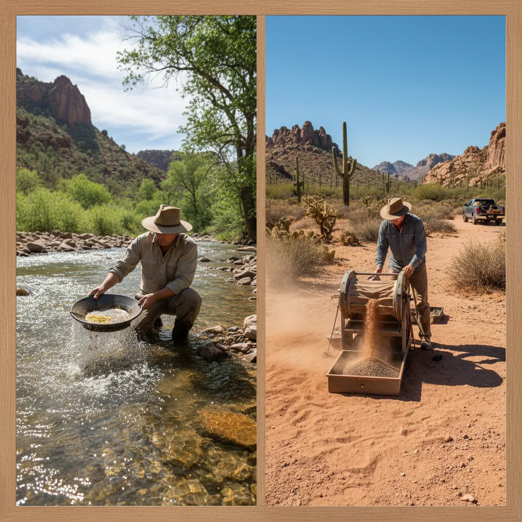
Wet Panning vs Dry Washing: Which Technique Works in Arizona
Arizona throws a curveball that most gold panning guides ignore: for much of the year, in much of the state, there isn’t any water. This isn’t Colorado where every creek runs cold and clear year-round. In southern and western Arizona, many gold-bearing washes are bone dry for 10+ months.
Wet panning works at Lynx Creek, the Hassayampa, and other perennial streams around Prescott. Standard technique — fill your pan, submerge, wash out the lighter material. If you’ve panned anywhere else, you know the drill. The gold panning equipment guide covers the basics.
Dry washing is the desert alternative. A dry washer uses air flow (either bellows or a small blower) to separate gold from dry sediment. It’s slower than wet panning but it’s the only option when there’s no water. Dry washing is standard around Quartzsite, Wickenburg, and the lower desert areas.
Desert-specific technique: In Arizona desert washes, gold doesn’t behave like it does in rivers. Flash floods — not continuous flow — move material. Gold deposits where flash flood water slowed and dropped its load. Look for debris lines on hillsides above washes — they mark high-water levels from past floods. The gold often concentrates in hillside deposits above the current wash channel, not in the wash bottom where flowing water would normally trap it. Understanding the full range of gold mining techniques helps you adapt to Arizona’s unique conditions.
This is a fundamental difference from river prospecting. In a river, you read current flow and bedrock traps. In an Arizona desert wash, you read flash flood debris patterns and hillside deposits.
When to Go: Seasonal Guide by Region
Arizona gold panning has a seasonal rhythm dictated entirely by heat and water.
October through April — Prime season for the lower desert (Quartzsite, Wickenburg, Congress). Temperatures are manageable — 60s–80s during the day. This is when the snowbird prospectors descend on Quartzsite and the gem shows run.
March through May and September through November — Best for the Prescott area and Bradshaw Mountains. Spring brings snowmelt to the higher creeks, increasing water flow and exposing fresh material. Fall offers comfortable temperatures and lower water, exposing bedrock.
Summer (June through August) — Dangerous in the desert, tolerable in the mountains. I do not recommend desert prospecting when temperatures exceed 100°F, which is common below 4,000 feet from June through September. The Prescott area (5,400 feet elevation) stays cooler — high 80s to low 90s — and Lynx Creek is pleasant through June. By July, even Prescott gets afternoon monsoon thunderstorms that can flash flood the creeks with zero warning.
| Region | Best Months | Water Availability | Temperature Range |
|---|---|---|---|
| Prescott / Lynx Creek | Mar–May, Sep–Nov | Year-round | 50–85°F |
| Bradshaw Mountains | Apr–May, Sep–Oct | Seasonal streams | 55–85°F |
| Quartzsite / Desert | Nov–Mar | Essentially none | 55–75°F |
| Wickenburg | Oct–Apr | Minimal | 60–85°F |
Essential Gear for Arizona Gold Panning
Arizona prospecting needs different gear than mountain stream panning. Everything I recommend for beginners in my equipment guide still applies, but add:
- Water — Bring way more than you think you need. I carry a gallon per person per hour for desert outings. Not kidding.
- Sun protection — Wide-brim hat, long sleeves, SPF 50+. Arizona sun at 4,000 feet will burn you through a T-shirt.
- Snuffer bottle — Essential for fine Arizona gold. The Pro-Line with the wider tip works well. Arizona gold is often tiny enough that beginners confuse it with pyrite — knowing how to identify gold vs pyrite saves frustration.
- Crevicing tools — A set of screwdrivers and dental picks for cleaning bedrock cracks. Arizona bedrock crevices trap gold effectively.
- Metal detector — If you’re hitting the Rich Hill or Wickenburg areas, a gold-capable detector (like the Minelab Gold Monster 1000) gives you access to nuggets that panning won’t find. Check out the basics of metal detecting for gold.
- Dry washer — For desert prospecting away from water sources. Not needed at Lynx Creek or other perennial streams.
- Snake gaiters or boots — Rattlesnakes are real and active from April through October.
How to Check Mining Claims Before You Go
Setting up on someone else’s active mining claim is the fastest way to ruin a prospecting trip. Arizona has thousands of active claims, especially in the Bradshaws and Rich Hill areas.
Step-by-step BLM claim check:
- Go to the BLM’s LR2000 database at blm.gov/lr2000
- Select “Serial Register Page” under Reports
- Search by geographic description — enter the township, range, and section for your target area (you can find these on USGS topo maps or using the BLM’s GIS tool)
- Review active case files — look for “Mining Claim” entries with an “Active” status
- Cross-reference with claim markers in the field — legal claims should have corner posts with the claim name and serial number
Easier method: Open the GoldFever.app mine map, zoom to your target area, and check for documented mines and claims. The app pulls USGS mine data and makes it filterable by mineral type, status, and location — so you can see exactly where Arizona’s documented gold mines are clustered and plan your trips around the densest zones.
Safety Tips for Desert Prospecting
Arizona prospecting can be genuinely dangerous in ways that mountain stream panning isn’t. Take these seriously.
Heat exposure — People die from heat stroke in Arizona every year. From May through September, low-elevation temperatures routinely exceed 110°F. Carry at least one gallon of water per person per hour in the desert. Start early (dawn), stop by noon, and don’t push it. If you feel dizzy, nauseous, or stop sweating, get to shade and drink water immediately.
Flash floods — Arizona monsoon season (July–September) produces violent thunderstorms that can dump inches of rain in minutes. A dry wash can go from empty to a wall of water in under an hour, even if the storm is miles upstream and you can’t see it. Never camp or linger in a wash when storms are possible. Check weather forecasts before every outing.
Rattlesnakes — Western diamondbacks, Mojave rattlesnakes, and black-tailed rattlesnakes are common in gold country. Watch where you put your hands and feet. Wear boots, not sandals. Most bites happen when people reach into crevices or step over logs without looking.
Abandoned mine hazards — Arizona has thousands of abandoned mines with open shafts, unstable tunnels, and bad air. Stay out of them. Every year people get hurt or killed exploring old mines. They’re interesting from the surface — leave it at that.
Navigation — Cell service is unreliable to nonexistent in much of Arizona’s backcountry. Download offline maps before you go. Carry a paper map of the area. Tell someone where you’re going and when you’ll be back.
What Kind of Gold Does Arizona Produce?
Arizona gold comes in several forms, and knowing what to expect helps you pick the right spots and techniques.
Flour gold and fine flakes — Most common at Lynx Creek, the Hassayampa, and lower-desert washes. These are tiny particles — often smaller than a pinhead — that require careful panning and a snuffer bottle to recover. Fine gold is frustrating for beginners but it’s what Arizona produces in the highest volume.
Pickers and small nuggets — Found in the Rich Hill area, Weaver Creek, Bradshaw Mountain drainages, and some Lynx Creek spots. Pickers range from 1-3mm and are big enough to pick up with tweezers. These are what make a day feel productive.
Nuggets — The Rich Hill and Weaver Creek drainages have produced nuggets weighing multiple ounces, even in recent years. Metal detecting is the primary recovery method for nuggets in Arizona. The state’s violent flood geology means nuggets can be found relatively close to their source veins, sometimes in hillside deposits rather than creek bottoms.
Wire gold and crystalline specimens — Occasionally found in quartz veins, especially in the Crown King and Bradshaw Mountain districts. These are collector pieces worth significantly more than their gold weight. If you find gold still attached to quartz matrix, don’t crush it — get it appraised as a specimen first.
Arizona gold also tends to be high purity — commonly 85-92% pure, which gives it a rich yellow color compared to the paler gold found in some other gold-producing states. Some Arizona placers also produce magnetite, garnets, and occasionally small rubies alongside the gold.
Explore Arizona Mines with the Gold Fever App
Arizona has over 900 documented gold-bearing mines in the USGS database. The GoldFever.app plots every one of them on an interactive map with mine names, mineral data, location coordinates, and operational status. You can filter by mineral type to see only gold mines, zoom into any region, and plan trips around the densest clusters.
The app runs on your phone, so you can pull it up in the field to check nearby mines, identify drainages downstream of historic gold producers, and cross-reference mine data with the terrain you’re looking at. It’s free and it works offline once you’ve loaded the tiles.
If you’re exploring where gold is found across the entire US, the map covers all 50 states with USGS data.
FAQ
Where can I pan for gold for free in Arizona? Lynx Creek Day Use Area in Prescott National Forest is the most popular free gold panning spot in Arizona. No permits, no fees — just bring a pan. Most BLM land in Arizona is also open to free recreational panning with hand tools.
Do you need a permit to pan for gold in Arizona? No. Recreational gold panning with hand tools (pan, classifier, crevicing tools) does not require a permit on BLM or National Forest land in Arizona. Motorized equipment and suction dredging require permits.
What is the best creek to pan for gold in Arizona? Lynx Creek near Prescott is consistently the most productive and accessible creek for gold panning in Arizona. The Hassayampa River and Big Bug Creek are strong alternatives with less prospecting pressure.
Is gold panning legal in Arizona? Yes. Gold panning is legal on BLM and National Forest land in Arizona without a permit. It is not legal on State Trust land, national parks, tribal land, or active mining claims without authorization.
Where is the most gold found in Arizona? The Prescott–Bradshaw Mountains region has the highest concentration of documented gold deposits in Arizona, centered around Lynx Creek, Rich Hill, and the Crown King mining district. The La Paz placers near Quartzsite are the other major historic gold producing area.
Can you still find gold in Arizona today? Yes. Recreational prospectors find gold in Arizona every week at spots like Lynx Creek and Weaver Creek. The amounts are small — typically 0.05 to 0.3 grams per outing for hand panning — but the gold is real and recoverable. Metal detector operators in the Rich Hill area occasionally find nuggets worth hundreds of dollars. Arizona’s gold deposits are far from exhausted. Compared to California’s depleted placers, many Arizona sites see less prospecting pressure and still produce consistently.
What equipment do I need to start gold panning in Arizona? At minimum: a 14-inch gold pan, a classifier screen, a snuffer bottle, and a small vial for storing gold. For desert areas without water, add a dry washer. A complete gold panning equipment checklist covers everything from basic to advanced setups.