Published
- 13 min read
Gold Panning Near Me: Find Real Spots Using Mine Data
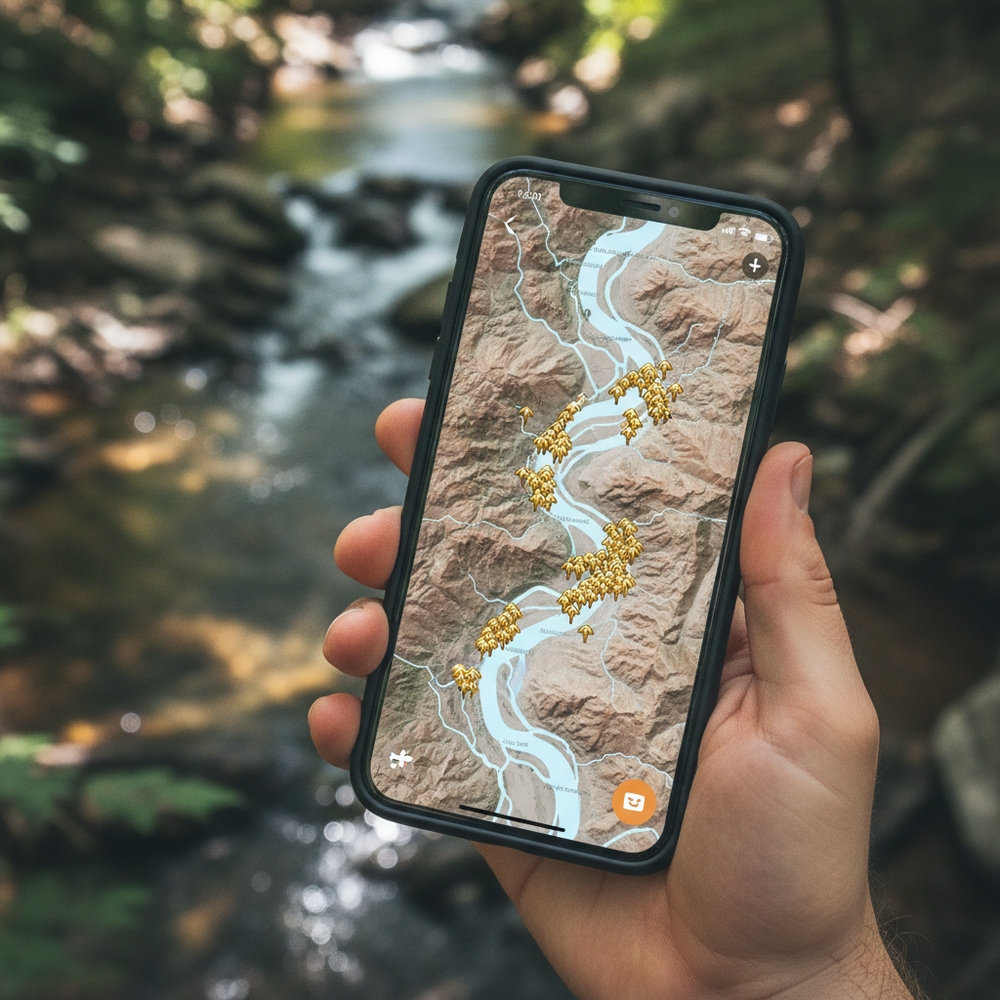
Most people who search “gold panning near me” end up at a tourist attraction where someone salted a trough with imported gold flakes. You pay $25, swirl a pan in a wooden sluice, and go home with a tiny vial that isn’t worth the gas it took to get there. I did exactly this at a place near Dahlonega, Georgia in 2023 and felt like I’d been scammed, because I had been.
The thing is, there’s almost certainly a real gold panning spot near you — a creek, a riverbank, or old mine tailings on public land where actual gold exists in the gravel. The US has over 50,000 documented gold-bearing sites in the USGS Mineral Resources Data System alone. That’s not a guess. I imported that database into GoldFever.app and mapped every single one. Odds are solid that some of those pins are within driving distance of wherever you’re sitting right now.
This article shows you exactly how to find them.
3 Ways to Find Gold Panning Spots Near You
Forget generic advice about “checking your state.” Here are the three tools that actually work, ranked by how useful I’ve found each one.
1. GoldFever.app Mine Map (Fastest Method)
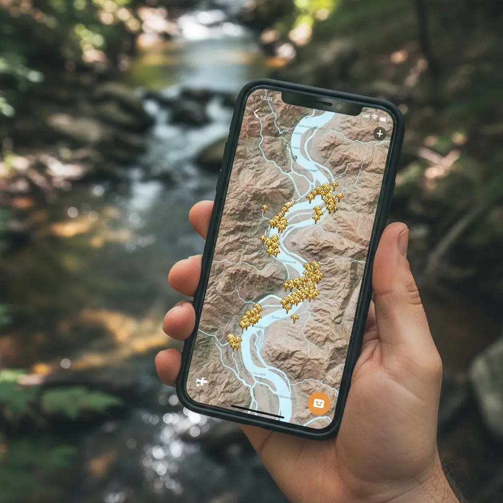
I built GoldFever.app specifically because I was tired of cross-referencing spreadsheets and PDFs to find panning spots. The app plots thousands of gold mines and prospects across the US using data from the USGS MRDS database and state geological surveys.
How to use it:
- Open the map and zoom into your area
- Gold pins mark documented gold occurrences — mines, prospects, and placer deposits
- Tap any pin for details: mine name, commodity type, status, and coordinates
- Filter for placer deposits specifically — these are the sites most relevant to recreational panning
Placer deposits (loose gold in stream gravels) are what you want for panning. Lode mines (hard-rock operations) can still have gold in their tailings, but placer sites mean the gold is already free in the sediment, which is the whole point. If you’re new to the distinction, I wrote a full explanation of what placer gold is and why it matters.
The map pulls from the same federal datasets that geologists and mining companies use. It’s not a list of “fun places to visit” — it’s raw geological data, which means some pins are in remote canyons and some are in someone’s backyard. You’ll need to verify access before you go, which brings us to method two.
2. BLM Mining Claims Database
The Bureau of Land Management maintains the LR2000 system — a searchable database of every active and closed mining claim on federal land. This is how serious prospectors find spots.
Why it matters: Active mining claims mean someone is currently extracting or has recently extracted minerals there. Where there are claims, there’s gold (or at least someone with enough confidence to file paperwork and pay fees). Closed or abandoned claims on BLM land are often fair game for recreational panning, since the land reverts to public use.
How to search:
- Go to the BLM LR2000 site
- Search by state and county
- Filter for “lode” or “placer” claim types
- Look for clusters of claims — dense clusters usually indicate a proven gold-bearing area
- Cross-reference the township/range/section with a map to find the actual location
The interface is clunky (it was designed in the early 2000s and hasn’t changed), but the data is solid. I’ve used it to find spots in Arizona and Colorado that don’t appear in any “best panning locations” listicle because nobody writing those articles actually checks claim records.
3. State Geological Survey Maps
Every US state with significant mineral history publishes geological survey data. Some states make this very easy — California’s got an interactive map. Others make you dig through PDFs from the 1970s. But the data exists.
Best state survey resources:
- California: California Geological Survey mineral land classification maps
- Colorado: Colorado Geological Survey’s mine and mineral occurrence database
- Arizona: AZGS interactive mineral occurrence map
- Georgia: Georgia EPD mineral resources database
- North Carolina: NCGS mineral resource maps
These surveys often include information the USGS data misses — small prospects, historical sampling results, and geological formations that indicate gold potential even where no mine was ever developed. If you want to go deep on a specific state, check our guides for gold panning in Arizona, Colorado, Georgia, and North Carolina.
Gold Panning Locations by State: Where the Data Points
Rather than give you a vague list, here’s what the actual mine data shows for the top gold-producing states. These counts come from USGS MRDS records — they represent documented gold occurrences, not tourist destinations.
California — The Obvious One
USGS gold sites: 5,000+
California has more documented gold occurrences than any other state, and it’s not close. The Mother Lode belt running through the Sierra Nevada foothills from Mariposa to El Dorado County is still the most productive recreational panning region in the country. The South Fork of the American River near Coloma — where James Marshall started the Gold Rush in 1848 — still produces fine gold in the gravel bars.
Northern California gets overlooked. The Klamath Mountains and Trinity Alps have extensive placer deposits with far fewer people working them. I’ve heard from prospectors who consistently find gold on the Trinity River and barely see another person all day.
The question everyone asks: is there still gold in California? Short answer — yes, a lot. Long answer — read that article.
Colorado — High Altitude Gold
USGS gold sites: 2,500+
Colorado’s gold is spread across the Rockies, with major concentrations in Clear Creek County, Park County, and the San Juan Mountains. Clear Creek at Idaho Springs is probably the most accessible panning spot in the state — it’s thirty minutes from Denver and you can find flour gold in almost any gravel bar.
The higher-elevation sites around Fairplay, Breckenridge, and Silverton have coarser gold but shorter seasons. Snow closes most mountain streams until June, and by October you’re fighting ice. I panned Clear Creek in November once and couldn’t feel my hands after twenty minutes. The gold was there, but so was borderline hypothermia.
Arizona — Desert Placer Gold
USGS gold sites: 1,800+
Lynx Creek near Prescott is Arizona’s go-to recreational panning spot, managed by the Prescott National Forest. The creek has been panned for over 150 years and still produces. The Bradshaw Mountains surrounding Prescott have hundreds of documented prospects, many accessible on BLM and Forest Service roads.
Rich Hill and Weaver Creek south of Congress are legendary placer areas. The dry washes in central Arizona can hold surprising amounts of flour gold — desert placers concentrate differently than mountain stream placers because flash floods do the sorting work of a permanent creek in a few violent hours.
Georgia — Where the First US Gold Rush Started
USGS gold sites: 500+
The Dahlonega gold belt in north Georgia was the site of America’s first major gold rush in 1828 — twenty years before California. The Chestatee River and Yahoola Creek near Dahlonega still produce fine gold. Consolidated Gold Mines in Dahlonega offers public panning, but the real spots are upstream on national forest land.
Lumpkin County alone has over 100 documented gold occurrences. The gold here is typically very fine — flour gold that requires patience and good technique. If you’re just learning how to pan, our beginner guide covers the technique in detail.
Alaska — Big Gold, Remote Access
USGS gold sites: 3,200+
Alaska has some of the richest placer deposits in the country, but access is the limiting factor. Nome Beach is one of the few spots where you can literally pan gold from the sand at the ocean’s edge. The Fairbanks mining district, the Fortymile River, and the Kenai Peninsula all have active recreational panning areas.
If you’re actually in Alaska, gold panning near you is almost guaranteed — the state’s entire interior is gold country. If you’re in the Lower 48 dreaming about Alaska, the travel investment is significant but the payoff can be real.
Other States Worth Checking
- North Carolina: The Reed Gold Mine area in Cabarrus County is where the first documented gold find in the US occurred in 1799. The Carolina Slate Belt has hundreds of prospects.
- Oregon: Josephine Creek and the Rogue River drainage in southwestern Oregon have excellent placer deposits.
- Idaho: The Boise Basin produced more gold than any other district in the Pacific Northwest. Orofino Creek and the Clearwater drainage are still productive.
- Montana: Libby Creek, Confederate Gulch, and Grasshopper Creek all have documented placer gold.
- Nevada: Mostly lode mining, but some placer areas exist near Round Mountain and in the Humboldt Range.
- New Mexico: The Ortiz Mountains south of Santa Fe and the Hillsboro district in Sierra County have gold.
For a complete breakdown of gold occurrence data by state, check the gold mines by state data analysis. And for a broader look at gold distribution across the country, see where gold is found in the United States.
How to Verify a Spot Before You Go
Finding a pin on a map is step one. Actually going there requires a bit more homework.
Check Land Status
This is the most important step most people skip. Gold panning legality depends entirely on who owns or manages the land:
- BLM land: Generally open to recreational panning with a gold pan, no permit required in most cases
- National Forest land: Usually open for casual prospecting — some forests require a permit, most don’t for hand panning
- State land: Varies wildly by state. Some states allow it, some prohibit it, some require permits
- Private land: Absolutely not without written permission from the landowner
- National Parks and Monuments: No. Never. Don’t even think about it
- Active mining claims: Off limits unless you have the claim holder’s permission
I cannot stress this enough: check the laws for your specific state before you go. The penalties for panning in the wrong spot range from a warning to criminal charges depending on the jurisdiction. A guy I know got his equipment confiscated on a state park river in Oregon because he assumed public waterway meant public panning. It doesn’t always.
Verify Access
Some USGS mine pins are on land that’s now private property, inside a military base, or at the bottom of a reservoir. The database records the geological occurrence, not whether you can drive there and start panning today. Always check current land ownership using your county assessor’s website or the BLM’s land status maps.
Check Current Conditions
Rivers flood. Roads wash out. Seasonal closures exist. A quick call to the local BLM field office or ranger station takes five minutes and can save you a wasted trip. I drove three hours to a spot in the Sangre de Cristo Mountains once only to find the forest road gated for the winter. Could’ve been avoided with one phone call.
Gold Panning Near Me vs. Abandoned Mines Near Me
People often conflate these two searches, but they’re different activities. Gold panning near me is about finding a creek or river where you can recreationally pan for gold in stream gravels. Abandoned gold mines near me is about locating and exploring historic mine sites — the structures, tunnels, tailings, and artifacts left behind by past mining operations.
There’s overlap — you can absolutely pan the tailings at an old mine site, and some of the best panning spots are downstream from historic mines where decades of erosion have been steadily releasing gold into the waterway. But the mindset, equipment, and safety considerations are different. If you’re interested in mine exploration, that article covers what to expect and how to do it safely.
Getting Started: Your First Trip
If you’ve never panned before and just want to find gold near you, here’s the practical sequence:
- Open the GoldFever.app map and zoom into your area. Look for clusters of gold pins near waterways.
- Cross-reference with land status. Make sure the spot is on public land open to recreational prospecting. Check state-specific panning laws.
- Grab basic equipment. A 14-inch plastic pan, a classifier screen, and a snuffer bottle. Total cost: under $30. See the complete equipment guide for exactly what to buy.
- Learn basic technique. The shaking-and-tilting motion takes practice but isn’t complicated. Our beginner panning guide walks through it step by step.
- Focus on the right material. Inside bends of creeks, behind large boulders, on top of exposed bedrock, and in crevices where gold naturally collects. Read about how to find gold in rivers for the specifics.
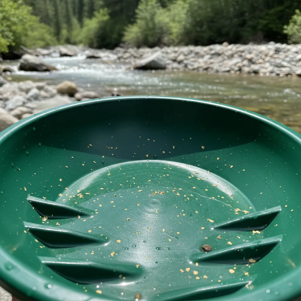
- Manage expectations. Most recreational panners find flour gold — tiny flakes worth pennies individually. The value is in the experience, the outdoor time, and the thrill of seeing real gold in your pan for the first time. If you’re doing it to get rich, this isn’t the hobby for you.
How Much Gold Will You Actually Find?
I want to be straight with you because nobody else is: recreational gold panning is not profitable. On a typical outing, an experienced panner might recover 0.1 to 0.5 grams of fine gold from several hours of work. At current gold prices (over $3,300/oz as of April 2026), that’s worth roughly $10-50. Gas, food, and time will cost you more than that.
But that’s not really why people do this. The first time you see a gold flake settle into the bottom of your pan — your gold, from a spot you found yourself — the dollar value becomes irrelevant. It’s part treasure hunt, part geology lesson, part excuse to spend a day outside on a creek. I’ve been doing it for years and still feel that jolt every time.
The people who stick with prospecting long-term eventually learn to read the geology, work more efficiently, and find spots that produce better. Some upgrade to sluice boxes or small dredges where different gold mining techniques become relevant. But the starting point is always the same: a pan, a creek, and some patience.
The Bottom Line
Gold panning near you is more accessible than you think. The USGS has documented tens of thousands of gold-bearing sites across the US, and between the GoldFever.app mine map, BLM claim records, and state geological surveys, you have every tool you need to find a real spot — not a tourist trap, not a pay-to-pan attraction, but actual gold-bearing ground on public land.
Find the pins on the map. Verify the land status. Grab a $12 pan. Go get your feet wet.